Monday 28 May 2018

28 May 2018 – Cycle/Walk: Topsham Circuit (Combined: 19.6 Miles -:- Walk: 13.8 Miles)

Synopsis: Cycled to Topsham for this walk. Walked to Woodbury Common via Woodbury. Includes Woodbury Fort, Bystock Nature Reserve and Point of View chapel. Train Lympstone to Topsham.

GPS Tracklog Download (.gpx) Microsoft OneDrive -:- Google Drive


Topsham to Lympstone via Woodbury Common 003Topsham to Lympstone via Woodbury Common 008Topsham to Lympstone via Woodbury Common 020Topsham to Lympstone via Woodbury Common 022Topsham to Lympstone via Woodbury Common 030Topsham to Lympstone via Woodbury Common 057
(selection of photos from Flickr photo set – use link above to view album)
Topsham to Lympstone via Woodbury Common 001
[Topsham]: Railway station.

Plan ‘B’. The reason being, Plan ‘A’ required bus travel, and this being a bank holiday, that was strictly limited. So, the night before, I sat down and quickly plotted this walk, based upon bicycle and train transport. To kick-start the day, all that was required was a 3 mile cycle ride to the railway station at Topsham. I parked my bicycle in the station cycle rack and sat on a bench to get into my walking boots. I slung my cycle shoes in the hedge and was then on my way.

Topsham to Lympstone via Woodbury Common 006
[Topsham]: A view of the Estuary Trail bridge over the River Clyst.


I wished to get into the country reasonably quickly, so I selected what I think is the shortest route avoiding the main road. It involved picking up the Exe Estuary Cycle Trail which crosses the River Clyst on the relatively new walk/cycle bridge, adjacent to the railway bridge, built to improve the trail route. The bridge could be glimpsed through the trees as I looked back.

Topsham to Lympstone via Woodbury Common 007
[Ebford]: The village centre.


The village of Ebford is on the busy main road, which I had to cross, but once away from the enormous volume of traffic on the road today, headed for Exmouth beach, the village centre was actually quite tranquil and picturesque. Ebford Manor (Listed Grade II*) was just visible behind the houses at the village centre.


Topsham to Lympstone via Woodbury Common 011
The lane/track/path from Ebford leading in the direction of Woodbury.


I was soon leaving the village and walking along country lanes. The sun was strong and the air in the lanes very warm and humid. Part of this route I had walked before, but today I wanted to detour, taking another course, which involved me crossing another busy road, that to Woodbury. Across the road, I picked up a rutted track that was first perpendicular to the main road, then curving right in the direction of Woodbury. This was really easy level track walking through glorious countryside with little evidence of the busy road nearby.

Topsham to Lympstone via Woodbury Common 015
[My path into Woodbury]: A bit of confusion here!

My navigation was a little bewildering on leaving Bond’s Lane. I picked up a track which seemed to peter out near an entrance to what I think was a farm. I could make out the fact that the intended continuation from this point was in fact a green lane, still visible, but completely overgrown and impassable. I backtracked to the lane feeling rather glum. There was a public footpath sign by the corner of the lane, but without a map, it’s precise direction was unknown. Its direction seemed roughly right, and there being no other reasonable alternative, I decided to give it a go.

Topsham to Lympstone via Woodbury Common 017
[My path into Woodbury]: Skirting field boundaries, Woodbury visible just ahead.


I was glad I did, as it was, almost precisely, my intended course. It was obvious to me that the green lane has now been abandoned, and that walkers are now directed along this public footpath that runs adjacent to it, following field boundaries. This was fine as a walker, but it wouldn’t be quite so clever if on a bicycle, and for that reason, it’s rather unfortunate that the green lane has been deprecated. To transport a bike along this stretch today, would require humping it over two stiles, one at each end.

Topsham to Lympstone via Woodbury Common 025
[Woodbury Common}: Woodbury Castle (Scheduled Ancient Monument) [Historic England List] comes into view.


Part way along this path the steeple of Woodbury parish church came into view, slightly sunken below the hedge line in front of me. I had chosen to bypass the village centre and make urgent tracks on towards Woodbury Common. I was getting hungry. The lane ahead of me rose gently and soon Woodbury Castle (Scheduled Ancient Monument) [Historic England List] came into view, and I decided to make that my lunch stop. There are trees at the fort, and this would provide some welcome respite from the intense rays of the sun. I reached the fort just before 14:00.

Topsham to Lympstone via Woodbury Common 029
Woodbury Castle (Scheduled Ancient Monument) [Historic England List]: The castle embankment.


I’ve always liked Woodbury Castle. It’s impressive in scale and location. And, on a sunny day like today, the sun streams upon it through the brightly coloured leaves of the trees all around. I confess, as kids, we scrambled all over it, as countless others must have done, and still do, with scant veneration for the castle’s time-honoured history. Today, my visits are more contemplative, if not quite so much fun.

Topsham to Lympstone via Woodbury Common 035
An intersection of bridleways. You pays your money ...


After my picnic lunch, sat on a log at the centre of the castle, I took a little time out to walk part of the circumference of the embankment. The ancient builders, without doubt, laid a significant stake on this plot of land. I walked on out to the nearby viewpoint and looked upon the Exe estuary and Exeter. I expected Exeter Cathedral to be the prominent architectural feature my eye would fall upon, but of course it wasn’t, it was the new IKEA store, in its blue and yellow, that forms the most recognisable object in the landscape.

My intention today was to only clip part of Woodbury Common which warrants more time than I shall allow on this walk. I crossed the road and headed for a gap in trees near the horizon. I then diverted onto a track that passes between extensive quarry workings. A few trees provided a little shade. I had to make a minor navigational correction at this point (day-dreaming once again).

Topsham to Lympstone via Woodbury Common 036
[Bystock Nature Reserve [Devon Wildlife Trust]]: An entry gate to the reserve.


A little way down a lane I had picked up was a welcome sign indicating an entrance point to Bystock Nature Reserve [Devon Wildlife Trust]. This is a favourite place of mine, a little oasis, probably much neglected. I knew from previous visits there was seemingly another entrance path to the reserve, but I had not explored it. Although not my original intention, this was too good to pass-up, so I decided to explore.

Topsham to Lympstone via Woodbury Common 037
[Bystock Nature Reserve [Devon Wildlife Trust]]: Following the tiny stream that supplies the 'pools' of the reserve.


I followed what was obviously the source of the ‘Ponds’, which was merely a miniscule trickle of water running off the common. Walking a little further along the path through trees and I had reached a point I recognised as being the far end of the reserve. I picked up the path that circumnavigates the plot and followed this until I reached a point where an alternative path branched off right and decided to explore this, as it would, if possible to follow, get me back on course.

Topsham to Lympstone via Woodbury Common 042
[Bystock Nature Reserve [Devon Wildlife Trust]]: A somewhat unofficial path to the reserve.


It became obvious that I wasn’t on a formally recognised path, but nevertheless one that a few people do use. I reached a five-bar gate which was padlocked, so I had to climb this. Continuing on, I eventually reached a barrier at the point where the path intersected a lane. Yet more evidence of a recognised but discouraged approach to the reserve. I was now very close to picking up my planned route, which was along St John’s Road, which is a relatively quiet lane running off of the common towards Exmouth, much preferred by me to the other much busier routes.

Walking St John’s Road also provided me with the added advantage of allowing me, once again, to pay my due respects to my great-grandmother, Sarah Elizabeth England (née Rockett), buried in the cemetery at the Church of St John in the Wilderness (Listed Grade II*) [Historic England List]. Sarah, who went under the name Elizabeth, took some hunting down through ancestral research to find, and is therefore a momentous treasure to me.

I continued on down St John’s Road, past South Lodge (of Bystock Court (Listed Grade II) [Historic England List]), having passed Higher Lodge earlier on on this road), and then picked up a busy road through an urban landscape at the back of Exmouth. A little road/track/path waking of a somewhat mundane nature was now required to get me to the point where a lane breaks off in the direction of Lympstone village.


Topsham to Lympstone via Woodbury Common 054
[Point In View (Listed Grade I) [Mary Parminter Trust]]: Exterior view.


It was 17:00 by the time I reached my intended lane. Of the two destinations initially of interest, only one was now possible, as the other, A La Ronde [National Trust], would unfortunately be closed. This left me the delightful The Point in View (Listed Grade I) [Historic England List]. This is the chapel created by the Misses Parminter cousins who built nearby A La Ronde. Miss Jane is buried here. It’s lovely.


I walked on, and, as expected, A La Ronde was closed. I stopped briefly by the gate to glance in at the building. If only I’d got up earlier! So, I passed by, and wandered down the lane to the main road. Subsequent to my walk, I happened to note that the rather uninspiring garage on the corner is a listed building. So, yes, Haldon Motors (formerly Pearson’s Garage) (Listed Grade II) [Historic England List], is of greater interest than one might at first think. It is thought that it was probably originally a lodge to A La Ronde (GSV).

Once I’d crossed the busy main road, no easy matter, it was simply a matter of following lanes, tracks and footpaths down the hillside into Lympstone. There were some pleasant views out over fields down to the Exe Estuary to be had as I went. I heard a train travelling in the Exmouth direction, which I knew meant that I had about 10 minutes before it returned in the direction of Exeter. I arrived at Lympstone railway station with a minute to spare. The train was extremely packed, but I wasn’t concerned, as mine’s was only a short hop back to Topsham.

I collected my bike, swapped my hiking boots for cycling shoes, and was soon cycling home. It was lovely to find such highly enjoyable hiking right on my doorstep. It proved to be an excellent plan ‘B’ after all.

UK weather: May 2018 hottest since records began in UK – BBC News 02/06/2018. I can believe it!

Cycle/Walk Statistics:

Total Distance (Combined Cycle/Walk): 31.6 km / 19.6 miles -:- (Walk): 22.2 km / 13.8 miles
Elapsed Time (Combined Cycle/Walk): 7hrs 50min -:- (Walk): 7hrs 04min
Moving Time (Walk): 6hrs 34min
Stopped Time (Walk): 0hr 30min
Total Ascent (Combined Cycle/Walk): 362 metres
Maximum Elevation (Combined Cycle/Walk): 221 metres

Buses: (none)
Train: Lympstone to Topsham – off-peak day single with Devon & Cornwall Railcard: £1.90
…… Normal ticket price, without railcard discount (33%) would have been: £2.90

Train return: 18:05 – 18.13 (8mins) – no changes

Thursday 17 May 2018

17 May 2018 - Walk: East Week, to Throwleigh, and then Cosdon Beacon (9.3 Miles)

Synopsis: A hike by bus from Exeter. Starts and ends with country walking and exploration of villages. High Dartmoor walking in-between, including Cosdon Beacon. Wild and remote, just as it should be.

GPS Tracklog Download (.gpx) Microsoft OneDrive -:- Google Drive
 
 
*** Please note, walk borders, but does not enter, MOD Okehampton Firing Range ***
 
Dartmoor Walk 004Dartmoor Walk 010Dartmoor Walk 018Dartmoor Walk 035Dartmoor Walk 044Dartmoor Walk 060
(selection of photos from Flickr photo set – use link above to view album) 
Dartmoor Walk 001
[Firestone Cross]: My bus drop-off point (designated bus stop)

An early start this morning, as I wished to catch the 7:50 bus from Exeter Bus Station heading towards Okehampton. The sun was shining, and the day promised to be fair, so I was keen to get going. I’d prepared a hiking route which I’d loaded to my mobile phone, along with some bus times for return journey. In researching the walk I’d discovered my bus journey was covered by one of the variations of Exeter Dayrider tickets (detail below), which made for economical travel. I was dropped at my hike start point, Firestone Cross, punctually, before 9am, and was on my way.

Dartmoor Walk 003
The open moorland of Dartmoor, my eventual destination, becomes visible from the track as I headed towards the village of East Week.


I had to walk a short stretch of the main road, from where I was dropped by the bus, to reach the narrow country lane that would take me my chosen route to East Week. Actually, it soon became less of a lane, more of dirt track, but absolutely no problem for a person on foot such as myself today. The hedgerows were a mass of spring colour, and I knew immediately that the wildflowers I’d see today would be a real treat on this walk. I caught this early glimpse of my target destination, Cosdon Beacon.

Dartmoor Walk 006
[East Week]: Just a few houses dotted along the road of this tiny hamlet.


I knew I was close to the first village of my walk today when a post box, almost secreted in a hedge, came into sight. East Week, the part that I saw, seemed tiny and lost in the countryside. Just a few houses strung out along the roadside. I was looking for the path to Throwleigh, which soon came into view.

Dartmoor Walk 013
Slightly ominous granite stepping stones - how water-logged can it get?


Looking ahead, down the path, I could see large granite boulders had been strewn along the way, as an aid to walkers. Is it really going to be that wet I wondered? As it happened, today, after little rain and much sun, the ground under foot was largely dry and easy going. But, looking all around me, there were signs that it needn’t always be like that, times when I’m sure the granite boulder stepping stones would be a most welcome for passing walkers.


Dartmoor Walk 016
[Throwleigh [Wikipedia]]: Church of St Mary the Virgin (Listed Grade I) [Historic England List]


The next village I came across was Throwleigh. I’d briefly explored the church here on a previous walk many years ago. I was keen to pay it a repeat visit. The church has a lovely setting. The interior is relatively plain, having had an extensive make-over during Victorian times. It’s not a large church, but despite it’s unpretentious looks, I find it quite appealing. I examined the Easter Sepulchre [my photo on Flickr], which is described as being 'unique'

Dartmoor Walk 027
[Throwleigh [Wikipedia]]: Every Thursday, this lady from the village installs these 'Do not park' signs. A little civic duty well executed.


I briefly dropped down through the small village of Throwleigh. Once again, as with East Week, it’s a tiny hamlet of just a few houses dotted along the road. I chatted with a lady waiting for the weekly bus that is perhaps Throwleigh’s only contact with the outside world. She was telling me about the signs she’d put up along the road, telling people not to park there, as it would obstruct the bus. Imagine that happening in the city – not in a month of Sundays, as my father would have said. The lady I spoke with was keen to preserve this connection with the ‘civilised world’.

Dartmoor Walk 029
Wildflowers in the hedge row. Red Campion, Stitchwort and Bluebell.


Needing to be on my way, I sought my route out of the village, which I found to be a steeply rising narrow lane, cut into the hillside. After a short distance the lane levelled out and opened up and I was in a typical wildflower lined hedged Devon lane. The hills of Dartmoor loomed ahead of me, but there was one more treat in store before I reached the open moorland.

Dartmoor Walk 033
[Higher Shilstone Farmhouse (Listed Grade I) [Historic England List]]: 'Higher Shilstone is an outstanding example of a Dartmoor longhouse.'

The next ‘item on my agenda’ was actually the reason I happened to be walking in this area. I’d stumbled upon, whilst browsing the Internet, the fact that arguably Devon’s oldest and finest traditional farm building is to be found nearby at Higher Shilstone Farmhouse Including Stables and Garden Walls Adjoining to South (Listed Grade I) [Historic England List]. The fact that it is listed Grade I tells one enough to know that this is an extremely important and highly regarded building. Parts of the building are deemed to date back to the 13th century. I could only glimpse it from the roadside, but it immediately transported me to another age when country living was hard and raw. There is a Dung Pit (Listed Grade II) and Barn and Linhay (Listed Grade II*) [Historic England List] nearby.

Dartmoor Walk 042
Looking south Fernworthy Forest can be made out on the horizon, and to the right of this, the valley in which marks the source of the River Teign can be seen.

The lane does a quick zig-zag before opening out onto open moorland. It’s a seemingly sudden change from pasture land to the wild openness of the moor. I walked a brief stretch of road before branching off right near a house, onto a dirt track that began my ascent onto the moor. I made a slight navigational error here, overshooting a little my planned route (this can be seen in my GPS trace). The walking became a little more strenuous as I battled my way through scrub, there being no discernible path on the ground. I startled a hare, or did it startle me? It had been resting in the shelter of a gorse bush when I came upon it. It darted away really quickly in that distinctly rapid bouncy way of hares (and tiggers). It’s so rare to see a hare in Devon. This is probably only the second that I’ve seen in all my walking.

Dartmoor Walk 039
Looking eastward it is easy to make out Castle Drogo [National Trust] still clad in scaffolding and tarpaulin and the massive restoration project continues.

Looking around me, to the south it was easy to make out Fernworthy Forest, a favourite haunt of mine. The valley which is the source of the Teign could be seen close by. To the east it was even easier to make out Castle Drogo (NT), as it remains clad in scaffolding and tarpaulin that reflected the light. To the west lay the high rugged peaks of the north moor. There was not a soul in sight. The sun dial [my photo on Flickr] on the parish church in Throwleigh spoke of the beloved solitary nature of the moor, and here it was to be experienced first hand. I had no complaints.


Dartmoor Walk 046
The Whit Moor or White Moor stone [Legendary Dartmoor] stone circle on the slopes of Little Hound Tor.

I rounded a gently sloping hill and hit upon a clear and distinctive track climbing the hillside. Suddenly I was making better progress, as walking was less of a struggle. I could see a ridge up ahead, and, as I was feeling hungry, decided to make that my lunch stop. As I approached the ridge, I could see that I was headed for Little Hound Tor, and on this tor is a stone circle. I stopped for a photo or two. There was a brisk breeze blowing on this exposed hill ridge. I chatted briefly with a walker that was intersecting my path. Afterwards I noticed a scar in the hill side [my photo on Flickr], presumably a mine working, and was able to duck down the embankment to find shelter in which to sit and eat my lunch.

Dartmoor Walk 047
The Whit Moor or White Moor stone [Legendary Dartmoor] stone circle on the slopes of Little Hound Tor can be seen in the middle-distance.

Once I’d finished my lunch, I set off from Little Hound Tor. The course I needed was a very distinctive wide track along the hill ridge in the direction of Cosdon Beacon, which was to be the highest point on my walk today. As is the way with moorland walking, there was no shelter from the direct rays of the midday sun; I was getting quite a roasting. But the advantage of such glorious weather was that I could see for miles in all directions. As a moor walk with far-reaching views, this has be hard to beat.


Dartmoor Walk 048
Cosdon Beacon, Dartmoor


An old Ordnance Survey trig point marks the highest point of Cosdon Beacon. These trig points no longer serve any mapping purpose, but they remain useful direction markers for walkers. A couple had reached this point before me, having approached from the opposite direction to me. Their intention was to walk as far as Little Hound Tor and view the stone circle. They’d been warned against taking the route from which I’d come, having been told it was very wet. Look at the OS map and yes, you’ll see marshes in several locations, but my path had been dry underfoot.

Dartmoor Walk 051
On the northern slope of Cosdon Beacon, looking northward.


My next intention was to walk to South Zeal, from where I was to catch a bus homeward. Coming off Cosdon Beacon I was treated to views for miles all around. Ahead of me lay a wide expanse of north Devon countryside. This is some of the best of Devon.

Dartmoor Walk 052
A track/path off the open moorland of Dartmoor, headed in the direction of South Zeal.


The path once again returned to being rather indistinct at this point, which was of little concern to me. I had a route recorded on my mobile phone, and simply followed this, which I knew would connect me with a track leading off in the direction of South Zeal. The descent was relatively steep until I reached the track where it moderated.

Dartmoor Walk 053
A track/path off the open moorland of Dartmoor. What I mistakenly took as my route!


Not far along the hedged track I reached a point where a footpath was signposted over a wall with stepping stones built into it. I thought this was my path and took it. It was a happy mistake. It actually took me some distance away from my intended route which was meant to follow the track virtually to the bus stop in South Zeal. Instead, I looped out of my way, and was glad I did. It followed this quaint little stream tumbling down the hillside in a mini-chasm lined with wild flowers and ferns. It was a delightful path.


Dartmoor Walk 063
[South Zeal [Wikipedia]]: Looking back towards the village as I climbed the lane to the main road.


On reaching a road, I took a turn left which I knew would take me into South Zeal. This was a little circuitous, as my intended bus stop is on the main road which bypasses the centre of the village. I wasn’t perturbed, as I had time to spare before my bus was due, and it was pleasing to see a little of South Zeal village. Eventually I climbed back up to the main road at the point where my bus stop was to be found.

Dartmoor Walk 064
[South Zeal [Wikipedia]]: The non-bus-stop bus stop.


I say, rather euphemistically, bus stop, whereas in appearance, it looks nothing more than a layby, without so much as a bus stop sign. I crossed the road to a visible bus stop serving buses travelling in the other direction, and this confirmed that I was standing in the right place. I had a 30 minute wait till my bus was due. There was no shelter to be had, so I was baked in the intense rays of the sun.

The bus arrived punctually, which I was thankful for, as I needed to get out of the sun. Roughly an hour’s journey on the bus was required to get me back to Exeter. It had been a superb day’s walking. It was such a pleasure to get back onto Dartmoor once again. I realise now that this bus that serves Okehampton and beyond is an extremely convenient means for me to get onto the moor. I think I need to plan some more walks based upon this bus route.

Previous occasion on which I’ve walked this way:

*** 13 Dartmoor Throwleigh – Flickr photo album of walk on 29th January 2006. This is pre-GPS (or my ownership of GPS), and also in a pre-blogging time, so just some scattered photos to view.

Walk Statistics:

Total Distance: 14.9 km / 9.3 miles
Moving Time: 5hrs 17min
Stopped Time: 40min
Total Ascent: 380 metres
Maximum Elevation: 553 metres

Buses: S, 6A & H
Exeter Dayrider Plus bus ticket: £6.00 (purchased on first bus of the day)

Saturday 5 May 2018

05 May 2018 - Walk: Coleton Fishacre (NT) to Berry Head and Brixham (10.4 Miles)

Synopsis: By train and bus to Torbay for coastal path walk Pudcombe Cove to Berry Head and then on to Brixham. Includes a brief walk around the gardens at Coleton Fishacre (National Trust). Glorious weather.

GPS Tracklog Download (.gpx) Microsoft OneDrive -:- Google Drive


Coleton Fishacre (NT) to Berry Head, and then Brixham 002Coleton Fishacre (NT) to Berry Head, and then Brixham 016Coleton Fishacre (NT) to Berry Head, and then Brixham 023Coleton Fishacre (NT) to Berry Head, and then Brixham 038Coleton Fishacre (NT) to Berry Head, and then Brixham 039Coleton Fishacre (NT) to Berry Head, and then Brixham 042
(selection of photos from Flickr photo set – use link above to view album)

Today’s walk was to be in familiar territory having been this way several times previously (see links below). But, this is a great stretch of coastline that is easily accessible for me by train/bus. An early start was required, as my train departed at 7:37. The bus from Paignton bus station dropped me at the bus stop at Nethway Cross (50.364802, -3.551474 [Ordnance Survey on Bing Maps]) which is at the intersection of the lane to to Coleton Fishacre with the B3205 Paignton-Kingswear road. It’s a 2.5 Kms (1.5 mile) walk to the entrance of Coleton Fishacre from the bus stop.

Coleton Fishacre (NT) to Berry Head, and then Brixham 001
Coleton Fishacre (NT): House and garden scene showing rhododendron growing beside the stream that courses through the centre of the valley.

Although Coleton Fishacre (NT) wasn’t a primary purpose for me today, it’s a lovely place, one that I repeatedly return to (this is my second visit this year). As a member of the trust, I enter for free, but if not a member, then it does need to be borne in mind that an entrance fee will be required at the property. An alternative to walking through the gardens of Coleton Fishacre would be to park at what I believe is named Coleton Park, which is to be found on the left at the top of Coleton Fishacre drive (50.351038, -3.534196 [Ordnance Survey on Bing Maps). There is a footpath that leads off from this car park that connects with the coastal path approximately 500 metres east of Pudcombe Cove.

Coleton Fishacre (NT) to Berry Head, and then Brixham 015
Coleton Fishacre (NT): Garden scene showing azalea and tree ferns.

I arrived at Coleton Fishacre (NT) slightly too early, as the property was still locked, and a small queue was forming at the entrance to reception. It wasn’t my intention to stay long in the gardens. I expected the azaleas and rhododendrons to be in flower, so I sought these out. This was the best colour to be found in the garden this early in the season. There were bluebells and wild garlic also in flower, carpeting the undergrowth below the tree ferns.

Coleton Fishacre (NT) to Berry Head, and then Brixham 010
Coleton Fishacre (NT): Garden scene showing what I think might be a form of rhododendron, but rather unusual in appearance. A lovely delicate flower.


There was one particular plant that appealed to me, a rhododendron I think, which was more subtle than is usual. It was hard to capture in a photograph, as I was unable to get that close.


Coleton Fishacre (NT) to Berry Head, and then Brixham 020
Pudcombe Cove: Looking back in the direction of Kingswear as I set off along the coast path.


I exited the gardens of Coleton Fishacre through the gate at the bottom of the valley. The coastal path is only a few metres from this gate. I hesitated briefly at the viewing point from which it is possible to look out on Pudcombe Cove, and far below, see the sea-water swimming pool created in the 1920s. No path to the sea now exists, but at one time there was a zig-zag path down to the tiny cove (an historic photo can be found in the garden shed). I passed a little time chatting to a friendly couple standing nearby. But with much walking to do, it was necessary for me to be on my way, and so I headed eastward, out of Pudcombe Cove.

Coleton Fishacre (NT) to Berry Head, and then Brixham 022
Coast footpath on the approach to Scabbacombe Sands.

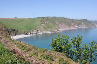
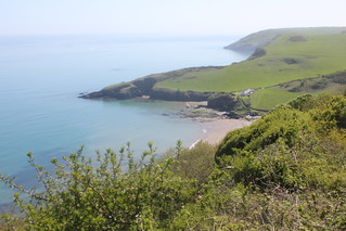
I climbed for a short distance through trees but was very soon heading out along a reasonably level stretch of coast path headed for the rocky headland near Ivy Cove. The path descended quite steeply here, but then levelled out once again, as I made for Scabbacombe Head. Skirting the headland it was only a short time before Scabbacombe Sands came into view. The path entered the shade of some trees, which were too inviting to pass-up, so, although rather early (12:30), I opted to break for a picnic lunch.


After my quick, 30-minute, binge, I set off once again, descending towards the beach at Scabbacombe Sands. I only halted very briefly, as it was then necessary for me to begin an arduous ascent back to the top of the cliffs. This I took at a slow steady pace.

Coleton Fishacre (NT) to Berry Head, and then Brixham 025
From a position near Crabrock Point, the coastal footpath on the approach to Man Sands.

There was a small amount of respite in the way of some level coastal path that took me towards Crabrock Point. Here the path ominously dropped once again, and down I went to near sea level at a beach named Man Sands. There’s a solitary building standing here, its purpose unknown to me, and a small lagoon just inland. Once again, I halted only briefly, as yet again I faced another steep climb out of here to the top of the cliffs.

Coleton Fishacre (NT) to Berry Head, and then Brixham 030
Man Sands: Looking back from the coastal path on Southdown Cliff.


Having reached the top of Southdown Cliff, I was pretty sure that was the last really stiff climb of the day behind me, a belief later proven to have been correct. A mix of level and mildly undulating path got me as far as Sharkham Point. From here, the view across St Mary’s Bay opened up in front of me.

Coleton Fishacre (NT) to Berry Head, and then Brixham 031
St Mary's Bay from the coast path.


I followed the path around St Mary’s Bay. There were more people milling around as I circled the bay, as there are a number of campsites in the neighbourhood. Children were enjoying themselves on the beach, but, thankfully, it was not necessary for me to drop down to the shoreline. I made good progress towards Berry Head.

Coleton Fishacre (NT) to Berry Head, and then Brixham 033
St Mary's Bay: A number of holidaymakers about, probably many from the nearby holiday parks.


I continued on in my intended direction and soon reached one of the old fortresses to be found here on Berry Head, South Fort. The formidable thick walls make for an impressive structure. The path here cut inland a little, to circle the South Fort, my route being across grass to North Fort, which I entered through an enormous gate structure, I headed for the Visitor Centre, just inside the entrance, and sought out some shade beside the building, to sit and eat an apple. A little well deserved rest.

Coleton Fishacre (NT) to Berry Head, and then Brixham 036
Berry Head: View looking east across Torbay.


Having ‘fortified’ myself (sorry!), I made my way out to the very furthest point on the headland, at which the cliff falls away steeply. It’s a good place to check-out your vertigo. From here I looked out across the broad sweep of Torbay. It was a sight to behold. There is an operational lighthouse situated here. The Light Between Oceans.


WP_20180505_16_16_43_Pro
Brixham: The Brixham Pirate Festival event was taking place, hence this pirate ship berthed at the jetty.

My walk was by now pretty much complete. I set off for Brixham for the purpose of finding a bus back to Paignton. What I next came upon was a complete surprise. Everyone, or so it seemed, was dressed in pirate costumes. Apparently it was Brixham Pirate Festival, something I’d not heard of, and wasn’t expecting at all. Brixham was packed. I will say I was impressed. People were really into the spirit of the event. There were stalls and sideshows, and even a pirate ship to walk around. It felt like everyone was in Brixham and having fun.

I feared for my chances of a seat on a bus out, but I needn’t have worried. A very efficient shuttle-bus service was ferrying people out, first to a park-and-ride car park nearby, and then on to Paignton and Torquay. I had a bus seat on an admittedly rather crowded bus. And I made good time to Paignton railway station, from where a train was due in about 10 minutes. I was soon being whisked in the direction of home.

It had proved to be a testing walk (see Total Ascent stats below), but somehow I had mustered the required strength and energy. And, yes, as crazy as this might seem, I thoroughly enjoyed the walking. It’s good to push oneself once in a while. And the weather had been perfect too.

*** 06 May 2009 – Walk: Coleton Fishacre to Paignton (16.6 Miles) – Wow! This was impressive, to have walked so far, and check-out the total ascent on this walk in the stats.
*** 19 February 2011 – Walk: Brixham to Kingswear (8.1 Miles) – The opposite direction to my walk today, and bypassing Coleton Fishacre.
*** 03 October 2015 - Walk: Hillhead to Colleton Fishacre (NT), then Kingswear (9.3 Miles) – A walk with a couple of ex-colleagues of mine. We cut inland through Coleton Fishacre and down to the Day Mark before picking up the coast path once again.

Suggested further reading:

Coleton Fishacre: The Garden by the Sea (Parks & Gardens UK)

Walk Statistics:

Total Distance: 16.7 km / 10.4 miles
Moving Time: 6hrs 03min
Stopped Time: 40min
Total Ascent: 741 metres
Maximum Elevation: 154 metres

Buses: 120 & 12 (Plus Bus ticket for Torbay purchased on train: £3.50)
…… Note: discount only applies to national railcards, not local railcards
Trains: Digby & Sowton to Paignton – off-peak day return with Devon & Cornwall Railcard: £5:70
…… Normal ticket price, without railcard discount (33%) would have been: £8.30

Train out: 07:37 – 08:48 (1hr 11mins) – no changes
Train return: 17:11 – 18:26 (1hr 15mins) – no changes