Saturday 29 August 2015

29 August 2015 - Cycle: Marker’s Cottage and Clyston Mill, Broadclyst (10.5 Miles)

Synopsis: A visit by bicycle to Marker’s Cottage and Clyston Mill, in the village of Broadclyst, both National Trust properties. A picnic lunch in the churchyard, which also served as a bike park.

Cycle route on sports activity tracker Runtastic
 
Clyston Mill & Marker's Cottage, Broadclyst 004Clyston Mill & Marker's Cottage, Broadclyst 005Clyston Mill & Marker's Cottage, Broadclyst 008Clyston Mill & Marker's Cottage, Broadclyst 017Clyston Mill & Marker's Cottage, Broadclyst 023Clyston Mill & Marker's Cottage, Broadclyst 025
(selection of photos from Flickr photo set – use link above to view album)

I’ve visited Killerton House and Gardens (NT) on many occasions. And I’ve known that there are three ‘satellite’ properties owned by the National Trust (see Killerton’s ‘places nearby’), which I’ve long intended to visit, but time has always always thwarted me. Today I intended to visit all three, but once again the clock was against me, and I got to just the two, Marker’s Cottage (NT) and Clyston Mill (NT). The third, Budlake Old Post Office (NT), will have to wait until a future date.

If it’s my intention to visit Killerton, I nearly always cycle, as it’s such an easy and safe cycle route. Today was no exception. On reaching Broadclyst I had thought I might picnic in one of the nearby fields, but the grass was wet, so I thought better of it. I made my way to the local churchyard where, as I’d expected, there were to be found a number of benches. I picked one by a wall facing into the sun and sat in the peace and tranquillity of the churchyard to eat my lunch.

With no particular plan in mind, I opted to secure my bike to one of the benches in the churchyard. I then chose to walk to Marker’s Cottage (Grade II* Listed), which I’d noted as I passed it earlier on my way into Broadclyst. It was only a five minute walk from the church.

Clyston Mill & Marker's Cottage, Broadclyst 001
Marker's Cottage (NT) – in Killerton estate colours


The cob cottage is painted in the Killerton estate colour of yellowish orange. It is a building of some considerable size suggesting this had been the property of a family of wealth. It is thought that the money came from the woollen trade, and the nautical references within the house, situated far from the sea as it is, are considered possible indicators of the international trade in goods that was once taking place.


On approaching the entrance to the house a notice requests that you ring the bell to gain access. A tug on the quaint bell pull soon resulted in a warm welcome into the house. I entered via a small vestibule, with the main hall being to the left, with a small living room to the right, to which I was led. The steward told me a little of the history of the house. Apparently the reason it is referred to as Marker’s, is that the earliest existing record of an inhabitant is one Sarah Marker in the early 18th century, although the house is thought to be a good deal older than that time.

Clyston Mill & Marker's Cottage, Broadclyst 002
Marker's Cottage (NT) - Inglenook The hall, showing the fireplace and stair tower

The house originally had only one floor, the ground floor. The entrance passageway leads into the main living quarters, the main hall where the fire would originally have been in an open hearth in the middle of the room. This fire provided heat for the house and was also where food would have been prepared. The inglenook chimney was added at a later date.


Clyston Mill & Marker's Cottage, Broadclyst 003
Marker's Cottage (NT) - oak panel partition wall


One of the main attractions of the cottage is the oak panelled wall that divides the hall from the parlour. Four of the original oak panels survive, with two having been replaced. The main reason for their survival was the fact that this wall had been covered in lathe and plaster which protected it. The oak panels and columns had been painted, paintings which survive. Those in the hall are somewhat darkened by the smoke from the fire, but those in the parlour are very well preserved.

Clyston Mill & Marker's Cottage, Broadclyst 006
Marker's Cottage (NT) - country house furniture


The downstairs rooms have been simply furnished with a substantial amount of old country furniture. The furniture includes a settle, chairs, oak chests and tables. The house had been divided into two, to form two worker’s cottages, which was how it was when it became part of the Acland estate. During Victorian times minor improvements were made such as the addition of a chimney in the parlour, and an extension added to the rear of the cottage.

Clyston Mill & Marker's Cottage, Broadclyst 009
Marker's Cottage (NT) - main bedroom


The first semblance of an upper floor that was added to the house was a single and simple bedroom space, possibly with a simple ladder to reach it. Subsequently the upper floor was extended across the whole house, subdivided into rooms, and a proper staircase introduced. The old stair tower has been rebuilt, up which I walked to the upper floor, at the top of which I entered the main bedroom. The bedroom has been furnished with furniture from the Victorian age.

Clyston Mill & Marker's Cottage, Broadclyst 010
Marker's Cottage (NT) - the attic, showing smoke stained rafters and rye thatch from the time before a chimney and fireplace was inserted into the building


Windows at the rear of the house are mid-floor, belying the fact there was no floor division originally. From the upper floor it is possible to look through a hatchway to the attic space and see the original beams and rye thatch blackened from the time when there was no chimney in the house.


Clyston Mill & Marker's Cottage, Broadclyst 018
Clyston Mill (NT) - entrance to mill with miller's cottage to the right


As interesting as Marker’s is, I needed to moving on if I was to spend time at Clyston Mill and attached Miller’s Cottage (Grade II Listed), so I said farewell to the very friendly steward and made my way back across Broadclyst. Clyston Mill can be reached via a path from the rear of the churchyard, a route that is signposted. Crossing a field that once contained the old mill pond, now only sheep, I reached the mill.

Clyston Mill & Marker's Cottage, Broadclyst 019
Clyston Mill (NT) - the mill sluice gate damaged during recent storm


Clyston Mill is well preserved, complete with all its internal milling machinery, which is working order. Although milling wasn’t taking place today, the mill wheel was turning, apparently with the help of an unseen electric motor. I was informed that the problem today was the fact that there had been a storm a few days previous, which caused the level of the River Clyst to rise dramatically, and this caused damage to the sluice gate, thus making it impossible to maintain the water level at sufficient height to drive the waterwheel.

Broadclyst to Cowley via Killerton 001
Broadclyst - water conduit


Clyston Mill has always suffered with waterpower problems. During Victorian times a steam engine was installed such that the mill might continue to operate when there was insufficient water from the River Clyst to drive the mill. The housing for this old steam engine still exists, and today houses the electric motor, but the original steam engine has long gone. An interesting fact from the National Trust steward: the steam engine, in addition to driving the milling wheel, was also used to power a pump that supplied water to the village centre along lead pipes (see photo: ‘Broadclyst to Cowley via Killerton 001’).


On the upper floor can be seen all the milling machinery, including three mill wheels. Two are operational, one is held open so that it can be inspected. The tenant works as miller, and there are days when the milling can be seen in action. The flour that is ground is made available to the kitchen at Killerton. And the organic Real Food shop in Paris Street, Exeter, is also a customer for the flour.

Clyston Mill & Marker's Cottage, Broadclyst 022
Clyston Mill (NT) - milk bottles from various local dairies, in various shapes, sizes and colours

Climbing one more floor, I entered the main storage area for the flour produced at the mill. There is a mechanical sack hoist that is capable of lifting the sacks of flour to this floor. There is a lovely set of old milk bottles in a series of display cabinets along the walls. I’d forgotten the fact that each dairy, and there were many of them, had their own shape of milk bottle, and their own branding. It harks of a world far removed from the standardised plastic milk containers of today.


There is also a quern, a hand propelled milling wheel, the oldest form of milling, used throughout the world for thousands of years. I’ve a feeling a feminist passed this way, as someone has objected to the wording on the information panel (look closely and you’ll see what I mean).

Clyston Mill & Marker's Cottage, Broadclyst 031
Clyston Mill (NT) - milk making and delivery was 'a cut throat business' - it would seem some things never change


One thing that made me smile, was that I read on one of the information panels that the milk trade was a ‘cut throat business’. Recent reports in the press of disputes between farmers and the supermarkets over the price they were offered for their milk caused me to think some things haven’t changed so very much.

I’d thoroughly enjoyed my visit to these two National Trust properties. Small they might be, but they’re packed full of interesting history, and are simply charming. And Budlake Old Post Office remains to be seen another day.


Cycle Statistics:

Total Distance: 17.0 km / 10.5 miles
Elapsed Time: 5hrs 32min
Moving Time: 2hrs 19min

Buses: (none)

Thursday 27 August 2015

27 August 2015 - Walk: Teignmouth and Shaldon (9.7 Miles)

Synopsis: Walk started with a swim. i.e. I walked to Topsham for a swim, and then caught a train to Teignmouth. Walked a loop inland from Teignmouth before joining coastal path into Shaldon.

GPS Tracklog Download (.gpx) Microsoft OneDrive -:- Google Drive


Teignmouth and Shaldon 005Teignmouth and Shaldon 008Teignmouth and Shaldon 016Teignmouth and Shaldon 029Teignmouth and Shaldon 040Teignmouth and Shaldon 044
(selection of photos from Flickr photo set – use link above to view album)

I’d been at Topsham Swimming Pool the day previous to this, in the afternoon, when there was a ‘float’ session taking place. The pool was full, and I obviously wasn’t going to get a good swim. I was told mornings were better, particularly if it was raining, as that deterred the young. So, I came up with this alternative plan, a combination swim and walk. Well, with the station being right on the doorstep of Topsham Pool, it seemed an obvious choice. It would make really good use of my time. And, put into action, this plan worked out really well, as I’ll outline below.

Teignmouth and Shaldon 001

As I wasn’t due to reach Teignmouth until 12:32 I decided to have some of my picnic lunch on the train, as that way I could clock some distance before breaking for further sustenance. The odd shower was forecast, but on arriving at Teignmouth station, all was set fair. I aimed to take the shortest route from here to Shaldon. Once across the Shaldon Bridge (Grade II Listed), that spans the River Teign, I branched right following the estuary upstream.


As I made my way, I had a good view of Ringmore (Grade II Listed), the rather eccentric looking house that stands right on the waterfront. It has always struck me as something of a folly, what with it’s castellated roof line and tower, and that I believe sums it up. I discovered the building is in fact listed, and on reading the details from its entry, found that it is described as ‘Scottish Baronial style’. What with The Ness being nearby, there would appear to be a strong Scottish influence in this neighbourhood.

Teignmouth and Shaldon 004
[Ringmore]: The path, as signposted, runs along the beach at this point, and is tidal.


On reaching the village of Ringmore the path I was following deviated left along the banks of the River Teign, I suddenly realised the next stretch, although relatively short, was tidal. Luckily the tide seemed to be far enough out for me to have a chance at this. It was comforting to find I wasn’t the only one on the river bank. There were people, I think from the camp site that runs right down to the banks of the river, who were strolling about, skimming stones, and generally milling around.

Teignmouth and Shaldon 006
[Ringmore]: The path leaves the beach via these rather uneven and quite steep steps.


I was looking for a way out of here. I had plotted a route that picked up a track. I was rather alarmed when I deduced that my way was up a really precarious looking set of steps. I was careful how I went, and didn’t feel particularly at risk, but was surprised by just what a poor shape these steps were in. I’m fairly agile and have reasonable strength, but many would not find this route at all easy.


Once up the steps the going became a lot easier. I was following a rough track which took me back to the road, which I crossed to pick up a track heading up the hill. I was walking the rather euphemistically named Dagra Lane. The track was very rough and rutted in places, which was manageable, my being on foot, but I couldn’t perceive any vehicle coming this way, other than perhaps a tractor. However, it is rather an interesting name, and I feel rather unusual for Devon. I don’t know the origins of its name.

Teignmouth and Shaldon 009
Dagra Lane - so close to where it connects with a lane, but deep water bars progress, except for the most intrepid, and that's not me.

I was making good steady progress as I gradually climbed the hillside. I thought it would be good to achieve the majority of the height gain before breaking to eat what was left of my lunch. I was within a very short distance of the lane Forches Hill when I was confronted with this large pool of water. I couldn’t see how to get past, short of taking my boots off, which today I wasn’t keen to do. I’d noted that there was an alternative, not too much longer, route that I could take, if this way became a problem. I backtracked and picked up this alternative route

Teignmouth and Shaldon 010
View from a corner of a field where I stopped to eat my picnic lunch


My deviation was easy going, if a little overgrown. The route followed the contours of the hill, only dropping in height very slightly. I was soon on the lane named Forches Hill, from where I returned to the course of my intended route. I was now headed out on a track rather quaintly named Butterfly Lane. The views from this hill ridge down to Teignmouth and Shaldon are superb. I chose a field with unobstructed views down to the river to break for something to eat and drink.

Teignmouth and Shaldon 013
Looking over Teignmouth Road out to Babbacombe Bay, as far as Hope's Nose


After lunch, I proceeded along Butterfly Lane from which, to the right, there was this wonderful view out over Babbacombe Bay. I eventually reached a T-junction, from where I branched right dropping steeply towards the busy Teignmouth Road. This was always going to be rather unpleasant. I had to carefully pick my way along this traffic laden section of coastal road until I could once again pick up the coast path.


At the stile leading into a field a group of ladies were pondering a small heard of cows. They weren’t sure if it was safe to proceed. I could instantly tell they were young heifers resting in the sun and they weren’t going to cause harm to anyone. This I informed the ladies, to which they said they’d watch me go through first. Whether they ever did follow me into that field, I really can’t say.

Teignmouth and Shaldon 014
From the coastal path, a view of The Ness in the foreground, with Teignmouth beyond

Once I’d gained the hill ridge the view, a view I’d experienced on several occasions, never fails to take my breath away. I reckon it’s one of the finest views in Devon. The Ness stands prominent in the foreground, masking Shaldon, with Teignmouth visible just beyond. And the whole sweep of coast past Exmouth and on eastwards towards Charmouth, can be seen from this point.

Teignmouth and Shaldon 015
[Shaldon]: View of Teignmouth from The Ness


It’s quite a steep drop from this point, following the hedge that runs along the cliff edge. The path then levels before rising to a viewpoint on the Ness, from where one looks out on Teignmouth, across the mouth of the River Teign. This is another amazing view, one that I never tire of.

Teignmouth and Shaldon 030
[Shaldon]: Homeyard's Botanical Garden The Lady of the Lake gives King Arthur his sword, Excalibur


I dropped from here, heading in the direction of Shaldon, but rather than continue into the village, I cut across the car park and up the hill. My purpose being to enter the old garden of the Homeyard’s. It’s a tranquil garden and one I’ve only recently discovered. It is quite simply planted, but it has some nice corners. I particularly like this area around a small pond. I wonder if it wasn’t used at one time by the Homeyards as a paddling pool, as there are steps down into the water.

Teignmouth and Shaldon 028
[Shaldon]: Homeyard's Botanical Garden The Lady of the Lake gives King Arthur his sword, Excalibur


Today, the park contained sculptures made from recycled materials. They’d been made by people from such groups as the Women’s Institute and Shaldon’s Over 60s Club. They were imaginative and well done, and added colour to my walk.

WP_20150827_17_22_51_Pro
[Teignmouth]: Oh, my goodness! I'm being followed by a giant escargot!


I didn’t stay long in Shaldon, as pleasant though it is. Instead, I chose to dart across the road bridge back into Teignmouth, and pick my way out to the seafront. Here I discovered there were more sculptures made, once again, from recycled materials. I found a bench next to this giant snail to stop for a snack and a drink.

That concluded my walk. It was now simply a matter of my strolling across town to the railway station to catch my train home. My rather impromptu plan of a swim and a walk had worked out really well. However, by the time I reached home, I was rather tired, for some reason. But it was the best kind of feeling tired.

Walk Statistics:

Total Distance: 15.61 km / 9.7 miles
Moving Time: 3 hrs 51 min
Stopped Time: 0 hr 33 min
Total Ascent: 412 metres
Maximum Elevation: 166 metres

Buses: (none)
Trains: Topsham / Teignmouth off-peak day return with Devon and Cornwall railcard £3.10
… Normal ticket price without railcard discount (33%) would have been: £4.70

Train out: 11:36 – 12:32 (0hrs 56mins) – no changes
Train return: 17:51 – 18:34 (0hrs 43mins) – no changes (to Digby & Sowton)

Monday 17 August 2015

17 August 2015 - Walk: Eggesford to Lapford (7.3 Miles)

Synopsis: Very quiet in the mid Devon countryside today, as always. One mill, one ruined manor house, and two churches, plus one. And lots and lots of wildflowers, although the season is nearly over.

GPS Tracklog Download (.gpx) Microsoft OneDrive -:- Google Drive


Eggesford to Lapford 007Eggesford to Lapford 056Eggesford to Lapford 094Eggesford to Lapford 103Eggesford to Lapford 114Eggesford to Lapford 130
(selection of photos from Flickr photo set – use link above to view album)
More Tarka Line Walks

This walk is walk ‘Yeoford’ (p.14) in the book More Tarka Line Walks by Peter Craske. This book followed upon an earlier publication, not surprisingly titled Tarka Line Walks. I believe that both of these books are now superseded by one bumper book called Tarka Line Walks. I don’t have a copy of this new book, but it’s likely that my walk today will be found in this new edition. The walks from this book are intended to be accessed from the Tarka Line that connects Barnstaple and Exeter. To see other walks from this book that I have completed, use the link under Tags to the right.

The walks described in More Tarka Line Walks are well written up, with an interesting narrative describing what will be seen during the walk, and adequate walking directions to navigate the route. An Ordnance Survey 1/25k map showing the walk route is printed for each of the walks, making it possible to navigate the route without a separate map, although having one’s own map is always advisable.

Although I’ve said above that this walk was taken from the book More Tarka Line Walks, in truth, it would be more accurate to say that it is derived from one of the walks. That is to say, I had to reverse the direction of the walk that I chose. The reason being, there are so few trains that stop at Lapford, and I wasn’t prepared to catch the 6:30 am train. So, instead, I happened upon the fact that there were trains out of Lapford in the evening, and was aware that all trains on this branch line stop at Eggesford, it was therefore a simple decision to make, as reversing the walk direction solved the matter entirely. As this was a relatively short walk, I decided I could catch the 11:12 from Digby & Sowton rail station, which got me to Eggesford at 12:05.

My ‘plus one’ reference to churches in the heading can be explained in that this post is primarily about the walk from Eggesford to Lapford. But, having time to spare on reaching Lapford, I went for a little stroll around the village of Lapford, and took the opportunity to look in on Lapford church (which is quite superb). Hence, two churches plus one. More about that later.

Eggesford to Lapford 002
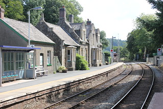
[Eggesford]: Eggesford Station

I shared a bench on the platform of Eggesford railway station with the train conductor. It was interesting to hear from him an explanation of the origins of the railway and the railway station that we were at. Apparently, the line runs through land belonging to the Eggesford estate. The permission of the lord of the manor, the Earl of Portsmouth, had to be sought to run the railway through his land. This was granted on the proviso that a station was provided (opened 1854) and all trains would stop there, hence we have today, Eggesford station, in the middle of nowhere.


An author of some notoriety, one Thomas Hardy, arrived at Eggesford Station in 1885, with the purpose of visiting Lord Portsmouth. A description of his experience he pens in a letter to his wife, ‘Dearest Em’, 13 March 1885.  But, perhaps ironically, Eggesford station still serves a useful purpose to this day, long after the demise of the estate manor (abandoned in 1911) if not what was originally intended by his lordship.

I crossed a bridge spanning the River Taw and looking over a field gate I could immediately see my first objective, The Church of All Saints (Graded II* Listed). The last time I came by this way I was thwarted in my attempt to gain access to this church, but today I faired better. My guide book mentions this church, saying that it was an ‘estate church’, much the same as the nearby station. Now, with no estate, just like the station, it seems a little stranded in the countryside. But in a way, this adds to its charm.


On entering Eggesford Church, the first thing that struck me was the monument to Arthur Chichester, 1st Earl of Donegall on the north wall of the church. This is one of three quite imposing monuments to be found in this church, indicative of the power and wealth of the family on whose estate this church was erected.

Eggesford to Lapford 027
[Eggesford]: The Church of All Saints (Graded II* Listed) "Font is Norman but much restored in 1919."


The font in the church is said to be Norman but “much restored”. It’s a bit vague, the text of the church listing, as to what exactly that means. I, although no expert, can see elements of the font which suggest Norman construction, particularly in the column, but struggle to see Norman style in much of the ornamentation. A far more typical Norman font, for me at least, is the font to be found at Hemyock.


From the church I followed a track for a short stretch before entering a field and following the field boundary up a gentle slope. Glancing to my right I could make out a large house in the distance, which I presumed to be the ruin of Eggesford House (Grade II Listed). Conducting some map and satellite image checks subsequent to my walk confirmed my conjecture as having been correct. I was pleased to gain sight of the ruins of this once fine old house. I’ve long known of its existence, but this was my first sighting of it. At one time it was a substantial manor house. It was abandoned in 1911 and artefacts sold off at auction in 1913. The house was subsequently left to quietly decay. I understand that now there are just fragments of exterior walls left standing. Although not alone in suffering this dismal fate, it does seem rather a shame for a part of our country’s heritage to have evaporated in this fashion. I’ve included below an old photograph from the Historic England View Finder collection adjacent to my, heavily cropped (as I was some distance from the property) image captured today.

Eggesford House, Wembworthy, Devon
Eggesford House, Wembworthy, Devon (25 Jan 1888) - © Historic England View Finder
Eggesford to Lapford 030a
[Eggesford]: Eggesford House (Grade II Listed) - English Heritage List - "Extensive ruins of country house. Built between 1820/30 for the Honourable Newton Fellowes (from house listing)
Eggesford to Lapford 037
Eggesford Fourways - war memorial

I dropped onto a lane not far from the Eggesford Fourways road junction. A war memorial stands in the centre of a small island in the middle of the road. From here I followed the opposite lane, past what looked to be a small terrace of old workers’ cottages. I then branched onto a track that took me through the farm buildings of Trenchard Farm onto a dirt track which hugged the side of a small strip of woodland, descending gradually as I went.

Eggesford to Lapford 048
Seems like the perfect spot for lunch


The track I followed led me into a lovely meadow on the valley floor. I didn’t need much persuading; this seemed the perfect place to break for lunch. Although I hadn’t clocked a great distance, this wasn’t to be a long walk, and so I had plenty of time in which to complete it. The day was warm, there was a delightfully summery vista, and I seemingly had the place to myself. That’s just how I like it.

Eggesford to Lapford 056
[Chenson Bridge]: On the banks of the River Taw


After lunch my way took me into a field in which there was a herd of rather unusual looking cattle, not a breed I recognised. Undeterred by the length of their horns, and they seemingly only mildly distracted by my presence, I was soon on the banks of the River Taw, which I followed for some distance. I reached Chenson Bridge, a small hamlet, where I crossed over both the river and the railway via a level crossing. There appeared to be an old station building here.

Eggesford to Lapford 067
Train on the Tarka Line


Then, after crossing the main road, with considerable care, I began a gradual ascent of a hill along a lane, knowing all too well I’d reach the top of the hill only to start dropping off it. Such was the nature of this walk. On my way I passed a substantial free-range chicken farm. I crossed the main road again, this time in the opposite direction, crossed over the railway, yet again, this time over a bridge, and came upon a sign pointing the direction to Nymet Mill, my next objective.

Eggesford to Lapford 073
Nymet Mill - old mill wheel


I wasn’t sure quite what I’d find at Nymet Mill, a mill that dates back to the Domesday Book, as we’ve lost so many of our old mills as they fell into disuse at the beginning of the 20th century. The building today is merely a dwelling. It was nice to find the old waterwheel still in place, even if looking rather dilapidated. The mill owner came out and spoke with me. He said he hoped to one day restore the appearance of the old waterwheel. The only other semblance of the old mill I saw today was the old mill race leading from the mill back to the river valley, which could easily be traced on the boundary of the garden.

This next photo is a panoramic stitch which was about the only way in which I could capture an image of the mill building.

Eggesford to Lapford 076_stitch
Nymet Mill
Eggesford to Lapford 093
[Nymet Rowland]: Church of St Bartholomew (Grade I Listed) English Heritage List - "The arcade is unusual being built of oak" (from church listing)

I encountered something of a potential hazard upon leaving Nymet Mill, in the form of a bull. The owner of the mill had warned me of this, and said I could cross his field if I preferred. I decided, on seeing the bull, and he seeing me, that discretion was the better part of valour. Back on my course, I then made a short detour to the church of Nymet Rowland, and was glad I did. This is a charming church containing much of interest. Perhaps one of the most striking things is the wooden arcade between the nave and the north aisle.

Eggesford to Lapford 106
Lapford Railway Station


Leaving the village of Nymet Rowland I gradually came down off the hill towards the River Yeo and the Tarka Line. I headed for Lapford Station which I reached at 16:30, where I found a bench on which to eat a light snack and take a drink.


I suspected I would arrive in Lapford early for my train, and that was the case; I had just over an hour to spare, so I thought I’d walk into the village. On setting off, I passed by what was once the old Ambrosia factory, which today houses a removals company. At one time there was a railway siding into the factory, and although the rails no longer exist, the front of the building is easily recognisable as an old railway station. The factory was built in 1928. I believe the company, which remains in business, evacuated these premises in the early 1970s. At that time, the closure must have been a major blow to the work opportunities of those living nearby. However, as we know ambrosia is the food of the gods, we have to be grateful that it is still manufactured in Devon. I’ve included below an old photo showing the working factory, and adjacent to this I’ve included my image from today.

The Ambrosia factory built in 1928
Eggesford to Lapford 108
[Lapford]: The old Ambrosia creamery factory that opened in 1928, and closed in the early 1970s.
Eggesford to Lapford 119
[Lapford]: The Church of St Thomas of Canterbury (Grade I Listed) - "The late C15 8-bay oak rood screen across both nave and aisle is well-preserved and amongst the finest in the country"

I wandered up the lane into Lapford, which is set on the hillside of the Yeo Valley. The village church, the Church of St Thomas of Canterbury, came into view, which I approached through the lych gate. Entering the porch I was immediately impressed by the old oak door that confronted me. Once in the church I came across the bench ends, many of which are  medieval in origin. And things just kept getting better. I then came across the rood screen which is stupendous, which I subsequently discovered ‘is amongst the best in the country. I find that the church is Grade I Listed, and it’s easy to see why.

On leaving the church, I spent a little time exploring Lapford village. It’s a quiet and pretty village, benefitting from the fact that it is set high on the hillside, well away from the main road.


Eggesford to Lapford 146
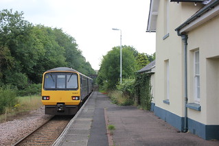
[Lapford]: Lapford Railway Station - my train comes into sight


I then returned to Lapford railway station to catch my train back to Exeter. I always enjoy walking in Mid Devon as it is in many ways the traditional Devon that one sees. Few people seem to find their way to this countryside. It had been an enjoyable day’s walk.

Walk Statistics:

Total Distance: 11.7 km / 7.3 miles
Moving Time: 3hrs 05min
Stopped Time: 56min
Total Ascent: 289 metres
Maximum Elevation: 165 metres

Buses: (none)
Trains: Digby & Sowton to Eggesford – off-peak day return with Devon & Cornwall Railcard: £6:10
…… Normal ticket price, without railcard discount (33%) would have been: £9.20

Train out: 11:12 – 12:05 (0hrs 53mins) – no changes
Train return: 17:48 – 19:03 (1hrs 15mins) – no changes (from Lapford)