Showing posts with label Book: More Tarka Line Walks. Show all posts

Monday, 17 August 2015

17 August 2015 - Walk: Eggesford to Lapford (7.3 Miles)

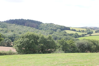
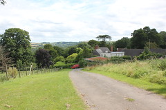
Synopsis: Very quiet in the mid Devon countryside today, as always. One mill, one ruined manor house, and two churches, plus one. And lots and lots of wildflowers, although the season is nearly over.

GPS Tracklog Download (.gpx) Microsoft OneDrive -:- Google Drive


Eggesford to Lapford 007Eggesford to Lapford 056Eggesford to Lapford 094Eggesford to Lapford 103Eggesford to Lapford 114Eggesford to Lapford 130
(selection of photos from Flickr photo set – use link above to view album)
More Tarka Line Walks

This walk is walk ‘Yeoford’ (p.14) in the book More Tarka Line Walks by Peter Craske. This book followed upon an earlier publication, not surprisingly titled Tarka Line Walks. I believe that both of these books are now superseded by one bumper book called Tarka Line Walks. I don’t have a copy of this new book, but it’s likely that my walk today will be found in this new edition. The walks from this book are intended to be accessed from the Tarka Line that connects Barnstaple and Exeter. To see other walks from this book that I have completed, use the link under Tags to the right.

The walks described in More Tarka Line Walks are well written up, with an interesting narrative describing what will be seen during the walk, and adequate walking directions to navigate the route. An Ordnance Survey 1/25k map showing the walk route is printed for each of the walks, making it possible to navigate the route without a separate map, although having one’s own map is always advisable.

Although I’ve said above that this walk was taken from the book More Tarka Line Walks, in truth, it would be more accurate to say that it is derived from one of the walks. That is to say, I had to reverse the direction of the walk that I chose. The reason being, there are so few trains that stop at Lapford, and I wasn’t prepared to catch the 6:30 am train. So, instead, I happened upon the fact that there were trains out of Lapford in the evening, and was aware that all trains on this branch line stop at Eggesford, it was therefore a simple decision to make, as reversing the walk direction solved the matter entirely. As this was a relatively short walk, I decided I could catch the 11:12 from Digby & Sowton rail station, which got me to Eggesford at 12:05.

My ‘plus one’ reference to churches in the heading can be explained in that this post is primarily about the walk from Eggesford to Lapford. But, having time to spare on reaching Lapford, I went for a little stroll around the village of Lapford, and took the opportunity to look in on Lapford church (which is quite superb). Hence, two churches plus one. More about that later.
Eggesford to Lapford 002
[Eggesford]: Eggesford Station

I shared a bench on the platform of Eggesford railway station with the train conductor. It was interesting to hear from him an explanation of the origins of the railway and the railway station that we were at. Apparently, the line runs through land belonging to the Eggesford estate. The permission of the lord of the manor, the Earl of Portsmouth, had to be sought to run the railway through his land. This was granted on the proviso that a station was provided (opened 1854) and all trains would stop there, hence we have today, Eggesford station, in the middle of nowhere.


An author of some notoriety, one Thomas Hardy, arrived at Eggesford Station in 1885, with the purpose of visiting Lord Portsmouth. A description of his experience he pens in a letter to his wife, ‘Dearest Em’, 13 March 1885.  But, perhaps ironically, Eggesford station still serves a useful purpose to this day, long after the demise of the estate manor (abandoned in 1911) if not what was originally intended by his lordship.

I crossed a bridge spanning the River Taw and looking over a field gate I could immediately see my first objective, The Church of All Saints (Graded II* Listed). The last time I came by this way I was thwarted in my attempt to gain access to this church, but today I faired better. My guide book mentions this church, saying that it was an ‘estate church’, much the same as the nearby station. Now, with no estate, just like the station, it seems a little stranded in the countryside. But in a way, this adds to its charm.


On entering Eggesford Church, the first thing that struck me was the monument to Arthur Chichester, 1st Earl of Donegall on the north wall of the church. This is one of three quite imposing monuments to be found in this church, indicative of the power and wealth of the family on whose estate this church was erected.

Eggesford to Lapford 027
[Eggesford]: The Church of All Saints (Graded II* Listed) "Font is Norman but much restored in 1919."


The font in the church is said to be Norman but “much restored”. It’s a bit vague, the text of the church listing, as to what exactly that means. I, although no expert, can see elements of the font which suggest Norman construction, particularly in the column, but struggle to see Norman style in much of the ornamentation. A far more typical Norman font, for me at least, is the font to be found at Hemyock.


From the church I followed a track for a short stretch before entering a field and following the field boundary up a gentle slope. Glancing to my right I could make out a large house in the distance, which I presumed to be the ruin of Eggesford House (Grade II Listed). Conducting some map and satellite image checks subsequent to my walk confirmed my conjecture as having been correct. I was pleased to gain sight of the ruins of this once fine old house. I’ve long known of its existence, but this was my first sighting of it. At one time it was a substantial manor house. It was abandoned in 1911 and artefacts sold off at auction in 1913. The house was subsequently left to quietly decay. I understand that now there are just fragments of exterior walls left standing. Although not alone in suffering this dismal fate, it does seem rather a shame for a part of our country’s heritage to have evaporated in this fashion. I’ve included below an old photograph from the Historic England View Finder collection adjacent to my, heavily cropped (as I was some distance from the property) image captured today.

Eggesford House, Wembworthy, Devon
Eggesford House, Wembworthy, Devon (25 Jan 1888) - © Historic England View Finder
Eggesford to Lapford 030a
[Eggesford]: Eggesford House (Grade II Listed) - English Heritage List - "Extensive ruins of country house. Built between 1820/30 for the Honourable Newton Fellowes (from house listing)
Eggesford to Lapford 037
Eggesford Fourways - war memorial

I dropped onto a lane not far from the Eggesford Fourways road junction. A war memorial stands in the centre of a small island in the middle of the road. From here I followed the opposite lane, past what looked to be a small terrace of old workers’ cottages. I then branched onto a track that took me through the farm buildings of Trenchard Farm onto a dirt track which hugged the side of a small strip of woodland, descending gradually as I went.

Eggesford to Lapford 048
Seems like the perfect spot for lunch


The track I followed led me into a lovely meadow on the valley floor. I didn’t need much persuading; this seemed the perfect place to break for lunch. Although I hadn’t clocked a great distance, this wasn’t to be a long walk, and so I had plenty of time in which to complete it. The day was warm, there was a delightfully summery vista, and I seemingly had the place to myself. That’s just how I like it.

Eggesford to Lapford 056
[Chenson Bridge]: On the banks of the River Taw


After lunch my way took me into a field in which there was a herd of rather unusual looking cattle, not a breed I recognised. Undeterred by the length of their horns, and they seemingly only mildly distracted by my presence, I was soon on the banks of the River Taw, which I followed for some distance. I reached Chenson Bridge, a small hamlet, where I crossed over both the river and the railway via a level crossing. There appeared to be an old station building here.

Eggesford to Lapford 067
Train on the Tarka Line


Then, after crossing the main road, with considerable care, I began a gradual ascent of a hill along a lane, knowing all too well I’d reach the top of the hill only to start dropping off it. Such was the nature of this walk. On my way I passed a substantial free-range chicken farm. I crossed the main road again, this time in the opposite direction, crossed over the railway, yet again, this time over a bridge, and came upon a sign pointing the direction to Nymet Mill, my next objective.

Eggesford to Lapford 073
Nymet Mill - old mill wheel


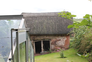
I wasn’t sure quite what I’d find at Nymet Mill, a mill that dates back to the Domesday Book, as we’ve lost so many of our old mills as they fell into disuse at the beginning of the 20th century. The building today is merely a dwelling. It was nice to find the old waterwheel still in place, even if looking rather dilapidated. The mill owner came out and spoke with me. He said he hoped to one day restore the appearance of the old waterwheel. The only other semblance of the old mill I saw today was the old mill race leading from the mill back to the river valley, which could easily be traced on the boundary of the garden.

This next photo is a panoramic stitch which was about the only way in which I could capture an image of the mill building.

Eggesford to Lapford 076_stitch
Nymet Mill
Eggesford to Lapford 093
[Nymet Rowland]: Church of St Bartholomew (Grade I Listed) English Heritage List - "The arcade is unusual being built of oak" (from church listing)

I encountered something of a potential hazard upon leaving Nymet Mill, in the form of a bull. The owner of the mill had warned me of this, and said I could cross his field if I preferred. I decided, on seeing the bull, and he seeing me, that discretion was the better part of valour. Back on my course, I then made a short detour to the church of Nymet Rowland, and was glad I did. This is a charming church containing much of interest. Perhaps one of the most striking things is the wooden arcade between the nave and the north aisle.

Eggesford to Lapford 106
Lapford Railway Station


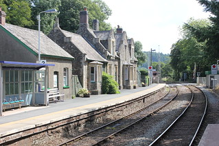
Leaving the village of Nymet Rowland I gradually came down off the hill towards the River Yeo and the Tarka Line. I headed for Lapford Station which I reached at 16:30, where I found a bench on which to eat a light snack and take a drink.


I suspected I would arrive in Lapford early for my train, and that was the case; I had just over an hour to spare, so I thought I’d walk into the village. On setting off, I passed by what was once the old Ambrosia factory, which today houses a removals company. At one time there was a railway siding into the factory, and although the rails no longer exist, the front of the building is easily recognisable as an old railway station. The factory was built in 1928. I believe the company, which remains in business, evacuated these premises in the early 1970s. At that time, the closure must have been a major blow to the work opportunities of those living nearby. However, as we know ambrosia is the food of the gods, we have to be grateful that it is still manufactured in Devon. I’ve included below an old photo showing the working factory, and adjacent to this I’ve included my image from today.

The Ambrosia factory built in 1928
Eggesford to Lapford 108
[Lapford]: The old Ambrosia creamery factory that opened in 1928, and closed in the early 1970s.
Eggesford to Lapford 119
[Lapford]: The Church of St Thomas of Canterbury (Grade I Listed) - "The late C15 8-bay oak rood screen across both nave and aisle is well-preserved and amongst the finest in the country"

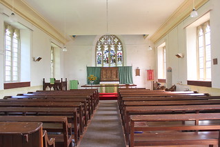
I wandered up the lane into Lapford, which is set on the hillside of the Yeo Valley. The village church, the Church of St Thomas of Canterbury, came into view, which I approached through the lych gate. Entering the porch I was immediately impressed by the old oak door that confronted me. Once in the church I came across the bench ends, many of which are  medieval in origin. And things just kept getting better. I then came across the rood screen which is stupendous, which I subsequently discovered ‘is amongst the best in the country. I find that the church is Grade I Listed, and it’s easy to see why.

On leaving the church, I spent a little time exploring Lapford village. It’s a quiet and pretty village, benefitting from the fact that it is set high on the hillside, well away from the main road.
 

Eggesford to Lapford 146
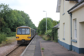
[Lapford]: Lapford Railway Station - my train comes into sight


I then returned to Lapford railway station to catch my train back to Exeter. I always enjoy walking in Mid Devon as it is in many ways the traditional Devon that one sees. Few people seem to find their way to this countryside. It had been an enjoyable day’s walk.

Walk Statistics:

Total Distance: 11.7 km / 7.3 miles
Moving Time: 3hrs 05min
Stopped Time: 56min
Total Ascent: 289 metres
Maximum Elevation: 165 metres

Buses: (none)
Trains: Digby & Sowton to Eggesford – off-peak day return with Devon & Cornwall Railcard: £6:10
…… Normal ticket price, without railcard discount (33%) would have been: £9.20

Train out: 11:12 – 12:05 (0hrs 53mins) – no changes
Train return: 17:48 – 19:03 (1hrs 15mins) – no changes (from Lapford)

Monday, 3 August 2015

03 August 2015 - Walk: Yeoford, Posbury and its hill fort, and Neopardy (7.5 Miles)

Synopsis: The old walk crew, ex-colleagues from DCC, gathered once again for this Tarka Line walk. Inspired by the book Tarka Line Walks. A Saxon invasion and a listed pig sty to intrigue.

GPS Tracklog Download (.gpx) Microsoft OneDrive -:- Google Drive


Yeoford & Posbury 004Yeoford & Posbury 014Yeoford & Posbury 018Yeoford & Posbury 033Yeoford & Posbury 034
(selection of photos from Flickr photo set – use link above to view album)
More Tarka Line Walks

This is walk ‘Yeoford’ (p.12) in the book More Tarka Line Walks by Peter Craske. This book followed upon an earlier publication, not surprisingly titled Tarka Line Walks. I believe that both of these books are now superseded by one bumper book called Tarka Line Walks. I don’t have a copy of this new book, but I do know that this walk today can be found in this new edition. The walks from this book are intended to be accessed from the Tarka Line that connects Barnstaple and Exeter. To see other walks from this book that I have completed, use the link under Tags to the right.

The walks described in More Tarka Line Walks are well written up, with an interesting narrative describing what will be seen during the walk, and adequate walking directions to navigate the route. An Ordnance Survey 1/25k map showing the walk route is printed for each of the walks, making it possible to navigate the route without a separate map, although having one’s own map is always advisable.

This was another of our ‘ex-colleagues’ walks (we did one last July). I set off on the train from Digby & Sowton railway station with Jenny, Mark boarded at Exeter Central, and Gill and Jeff met us in Yeoford. Our way took us back through Yeoford village, looking very sleepy, past the Mare and Foal (closed Mondays, rather frustratingly!), and then out along country lanes.

We suspected we were looking out to Castle Down, the site of the hill fort that saw action in 661, when the Saxons invaded. It was easy to imagine the Saxon hoard, said to be as many as 5,000, marching up the valley in the direction of the Dumnonian stronghold. The Saxons did defeat the Dumnonian army and take the hill fort, but not for long, as reinforcements from Wales came to the rescue and drove the Saxons (sometimes referred to as ‘the English invaders’, since they had invaded this country from the Continent) back (see also: Yeoford & Posbury 002 (with landscape markers)).

Yeoford & Posbury 009
The view west, looking away from Posbury Clump, which we were approaching along a footpath not far from Cholwell.


The lane we walked was relatively busy with car traffic, but it wasn’t long before we were branching right, and as soon as we did, our way became a lot quieter. Soon we were on a dirt track ascending gradually the hill slope. To our left, over high hedges, we could just make out what is known as Posbury Clump, a clump of trees on a little hillock. We approached a small farm building, Cholwell, and a dog came out to greet us. A lady came out to call the dog back, and spoke to us briefly.

Yeoford & Posbury 010
Chapel of St Luke (Grade II Listed) - English Heritage List


The lady with the dog that we met in the track by the house named Cholwell, in the process of being modernised, spoke of the chapel of St Luke's that we were approaching. She said that it was in the ownership of the Downes family. I believe this would be the Downes family that own a large 'Palladium' manor near Crediton. Reference to this link is contained in the article in Wikipedia for Posbury. Here it is stated that the land, chapel and [maintenance] fund was put into the hands of trustees, one of whom was James Wentworth Buller (1798-1865), of Downes House.


Examining the web site for St Luke's, I noted that there was a forthcoming summer fair event, that was advertised as being held at Downes House.

There is a fine photograph of Downes House (Grade II* Listed) on the St Luke's Country Fair event page …

See location of Downes on OS Leisure Map on Bing Maps


At the top of the dirt track the way forks in several directions. It is at this fork in the roads that St Luke’s Chapel is to be found. We entered the gate and discovered open grass and a bench, an ideal stop for our lunch. Although rather early in our walk, as our planned walk was relatively short, we chose to lunch here.

Yeoford & Posbury 011
Chapel of St Luke (Grade II Listed) - English Heritage List

St Luke's Chapel is small, simple, some might say stark, and rather quaint. There is nothing of any great antiquity within the chapel, nor do there appear to be any monuments within. The interior is very light and airy and seemingly in a very good state of repair. There are a small number of gravestones in the chapel grounds.


Yeoford & Posbury 012
Chapel of St Luke (Grade II Listed) - English Heritage List – The reredos, with the symbol of Alpha and Omega on one side, and, most curiously, a Chi Rho symbol on the other

What did catch my eye was the carvings in the wooden reredos. This was a simple design, with the symbol of Alpha and Omega on one side, and, most curiously, a Chi Rho symbol on the other. I notice that in some instances these two images can be combined to form a single symbol, so there is obviously deemed to be a strong association between these two symbols, but I know no more than this. Nor do I ever recall seeing the Chi Rho symbol in a church or chapel previous to this. My only previous direct experience of seeing this symbol was finding it on the side of a piece of Roman pottery to be found in the Royal Albert Memorial Museum in Exeter. I’ve included my photo of the Chi Rho on a sherd of pottery held at the Royal Albert Memorial Museum (RAMM), Exeter.

An intriguing piece of associated history is that the school, which once stood opposite the chapel, was established by Charlotte Mordaunt (1777-1847), wife of Richard Hippisley Tuckfield, and her main interest was in the teaching of deaf and dumb children. This was the founding movement of what was the precursor to the Royal West of England School for the Deaf, now named the Exeter Deaf Academy, that still functions in this role in Exeter to this day.

Yeoford & Posbury 015
The House of St Francis (formerly Posbury House) - occupited by 'The Community of the Franciscan Servants of Jesus & Mary'

Originally named Posbury House, now known as The Community of the Franciscan Servants of Jesus and Mary (rather a mouthful), and is home to a nunnery, originally founded in London by Grace Emily Costin. It moved to the Isle of Wight in 1937, but moved to here, Posbury House, to escape the danger of enemy bombardment during World War II. We did walk down the drive to the nunnery, but no nuns were in sight (possibly they were in their bunker). It has to be said that the location of the nunnery was most idyllic, seated in the neck of a valley, with St Luke's Chapel clearly visible on the far side.


Our walk then took us up the southern slope of Castle Down, which gave us a good impression of the view the Dumnonians would have had of the invading English, but gave us no sighting of the hill fort itself. We backtracked and circled around to the north side of the hill fort and this time we could clearly see the ramparts from the lane. The hill fort being on private land, it is not possible to approach it closely. Although only a sparse sighting of the hill fort, it was good to see it, and experience its commanding position.


We dropped down off Posbury Hill crossed an old bridge and entered the hamlet of Neopardy (nice name that). From the lane we could see the most attractive Neopardy Cottages (Grade II Listed), about as idyllic a scene as you'll come across anywhere in Devon. And then, turning off left from the lane, we entered a track, which passed a rather intriguing piece of country architecture, a listed pig house (Grade II Listed). Now, just what would the little pigs make of that. And it made me wonder, if I huffed and I puffed, could I blow the house down? Probably not.

Yeoford & Posbury 040
Yeoford - cottages


Climbing over a stile, we found ourselves in a wheat field. We made our way around the perimeter of the field to a point where it wasn’t exactly plain which was the correct way forward. It appeared as if crops had been planted across the public right of way. We chose a simple tactic of heading for a gate back onto the lane, as that was where we needed to be. At this point we were backtracking our way to Yeoford.

Yeoford & Posbury 041
Yeoford - railway station


At the railway station we briefly inspected the ‘library’ to be found in one of the buildings on the platform. We’d noted this on a previous visit. Books seem to be kept here, presumably so that travellers can wile away their time until their train arrives.


At this point, Mark, who wasn’t joining us for an evening meal, was to catch the train back to Exeter. The rest of us, on finding the village pub was to be closed on our walk day, opted for an alternative plan of retreating to Crediton. Jeff and Gill kindly obliged with lifts in their cars.

That evening Sarah, another ex-colleague of ours, joined us for supper at the Red Deer. It was the first time that I’d eaten there. I, and the others, all agreed, it was the perfect venue for an end-of-walk meal.

Jenny and I needed to catch the train back to Exeter, so, after our meal, we made our way to Crediton railway station. The others were making their own way in their cars.

It had been an excellent walk, with lots of interest, on a day that was perfect for walking. It had been dry, warm but not too hot, and a cool breeze throughout the day kept us fresh. And of course it was good to catch up with old friends and gossip along the way.

Highly incidental, and purely for amusement, here are some of the news stories we chatted about during our circumambulation :

• Spam email levels at 12-year low
• Obama's clean energy plan expected to boost renewables
• Smoking 'may play schizophrenia role'

Battlefield Walks Devon

I referred to the book Battlefield Walks Devon, by Rupert Matthews, for historical information about the Battle of Posbury of 661 (p.22). This book is very good at setting the scene of the battles it describes, providing historical facts about each battle, and the conditions in which the battles were fought. It also places the battle within the landscape through which the walks are based, which I find helps me visualise how each battle unfolded in the terrain that is viewed whilst on the trail. It describes the armour worn, weapons used and the tactics deployed at each battle.

The book is available to purchase on Amazon. Rupert Matthews has produced a short video which describes the content of this book, which can be viewed on YouTube.

See this and other books by Rupert Matthews on his web site. A summary of the walk Posbury 661 from Battlefield Devon can be viewed as a blog post by Rupert Matthews.

But, perhaps the last word, should be given to Æthelweard's Anglo-Saxon Chronicles for 661 which “describe Cenwalh of Wessex fighting a battle at Posentesburh.” This, one can assume, is the origin of much of what we know today about Posbury 661.

Walk Statistics:

Total Distance: 12.1 km / 7.5 miles
Moving Time: 3hrs 28min
Stopped Time: 59min
Total Ascent: 317 metres
Maximum Elevation: 180 metres

Buses: (none)
Trains: (Digby & Sowton to Yeoford) – Off-peak day return: £6.30

Monday, 14 July 2014

14 July 2014 - Walk: Yeoford to Copplestone via Colebrooke (11.9 Miles)

Synopsis: Walk with ex-colleagues from work. Train out to Yeoford from where we climbed steadily till we reached Colebrooke for a lunch stop. After exploring Colebrooke onto Copplestone for ice creams.

GPS Tracklog Download (.gpx) Microsoft OneDrive -:- Google Drive


Yeoford to Copplestone via Colebrooke 003Yeoford to Copplestone via Colebrooke 004Yeoford to Copplestone via Colebrooke 025Yeoford to Copplestone via Colebrooke 042Yeoford to Copplestone via Colebrooke 050Yeoford to Copplestone via Colebrooke 054
(selection of photos from Flickr photo set – use link above to view album)
More Tarka Line Walks

This walk is walk ‘Yeoford’ (p.14) in the book More Tarka Line Walks by Peter Craske. This book followed upon an earlier publication, not surprisingly titled Tarka Line Walks. I believe that both of these books are now superseded by one bumper book called Tarka Line Walks. I don’t have a copy of this new book, but I do know that this walk today can be found in this new edition. The walks from this book are intended to be accessed from the Tarka Line that connects Barnstaple and Exeter. To see other walks from this book that I have completed, use the link under Tags to the right.

The walks described in More Tarka Line Walks are well written up, with an interesting narrative describing what will be seen during the walk, and adequate walking directions to navigate the route. An Ordnance Survey 1/25k map showing the walk route is printed for each of the walks, making it possible to navigate the route without a separate map, although having one’s own map is always advisable.

Yeoford to Copplestone via Colebrooke 057
Yeoford - Railway Station - meet-up point - Jeff, Mark, Jenny & Gill

Today, a group of ex-colleagues of mine, planned to get together for a walk. The idea put forward was a train-based walk. Some of us boarded the train at the Digby and Sowton railway station, some at Exeter Central, and one person drove and met us at Yeoford Railway Station, where we were due to disembark. And, what do you know? It all went to plan, and we were ready to set off on our walk from Yeoford Railway Station on schedule at 10:44.


Yeoford to Copplestone via Colebrooke 001
Yeoford - Railway Station - meet-up point


Although I speak of Yeoford Railway Station, it's really nothing more than a platform these days. Well, that's not quite doing it justice, as an old hut is used as a store of second hand books, which one presumes are supplied for waiting passengers to pass the time. But, compared to old photos I've seen, this station, like so many, is a shadow of its former self. We pondered such thoughts on the bridge over the rail track prior to setting about our walk.

Our walk began along a quiet lane, slowly rising from Yeoford. The sun was putting in an occasional appearance, the day already quite warm. And we began our most serious business of the day, a sustained period of chatter.

Yeoford to Copplestone via Colebrooke 002
Pennylands

Near the brow of the hill we branched right, through a gate into a field, and then continued on following field boundaries. Over to our right we could see Pennyland's Farm. We'd been pondering how this name had come about. I conjectured the land was tough to coax a crop from, and perhaps a person was lucky to earn a penny from it. Certainly today the ground was parched, solid, and cracked like crazy paving.

Yeoford to Copplestone via Colebrooke 007
Approaching Colebrooke, the village Church of St Andrew's just visible over the hedges


It wasn't long before the church steeple of Colebrooke Church came into sight, just visible over the farthest hedge. We ploughed on (metaphorically, of course) until we entered the environs of the sleepy village. We discovered a picnic table just behind the church, so rested there and took a drink before proceeding.

Yeoford to Copplestone via Colebrooke 017
Colebrooke - St Andrew's Church


Then began the difficult task of locating my family in the cemetery. I'd visited the grave of my great aunt and uncle before, but that was some years back, and I couldn't remember just where the grave was. Luckily I had a photo of the grave. A circuit of the graves around the church yielded nothing, and then we recalled an overflow graveyard at the back of the church. On entering that graveyard (apparently once the site of alms houses), the tree behind the grave immediately gave its location away.

Yeoford to Copplestone via Colebrooke 012
Colebrooke - St Andrew's Church - gravestone of William Henry Madge and his wife Elizabeth Ann


And so I had my photo taken kneeling beside the grave of my great aunt and uncle, Elizabeth Ann Madge née Willcocks and William Madge. Rather poignant is the date of their deaths. Elizabeth passed away just ten days after her husband William. It is said that she was grief stricken, and died of a broken heart.

Yeoford to Copplestone via Colebrooke 018
Colebrooke - 'Bell Inn Cottage'


William Madge and Elizabeth Ann Willcocks were married by Isidore Daimpré in 1889 at St Andrew’s Church (Listed Grade I), Colebrooke. They set up home in what is today named Bell Inn Cottage, as shown here. I understand they lived in the right hand portion of this building, with William operating a cider press in the room on the left. William had a number of orchards in the vicinity of the village.


As it was by this time nearly 13:00, we decided to take advantage of the picnic bench we'd previously sat at, and make that our lunch stop. Out came our picnics and in we tucked. And still the nattering continued.

Yeoford to Copplestone via Colebrooke 023
Colebrooke - St Andrew's Church - medieval bench ends

After lunch we entered St Andrew's Church (Grade I Listed). It is obviously deemed an important church, although sadly heavily restored and little of the ancient church to be found these days. Perhaps one of the more interesting finds is a pair of carved bench ends near the entrance to the chancel, which are wonderfully sculptured, and evidently of medieval origin.

There was an unusual looking arch at the junction of the nave with the south transept, near the pulpit, which we couldn’t make out. A little background reading subsequent to our visit informs me there was once an earlier south transept, and the arch seen today is all that remains of this previous transept.


Yeoford to Copplestone via Colebrooke 021
Colebrooke - St Andrew's Church – Roll of Service – WWI (1914-1918)

One last objective for me was to find the name of the vicar who married my relations, as his name looked rather untypical on the copies of the marriage certificates that I have. And his name is indeed as I had read it, in that it is Isidore Daimpré, vicar at St Andrew's 1885-1922. He can be found in the 1901 census as 'clergyman (Church of England) and school master'. He published A Short Account of the Parish and Church of St Andrew, Colebrooke. On this image, of the Roll of Service plaque on the wall of the church, can be seen the six sons of Revd. Daimpré who served their country during WWI, of which it is said he was very proud.

One thing that did puzzle us about the Church of St Andrew, and that was the little ‘windows’ in the walls leading into the south transept. I'd not seen their like before and couldn't explain them. Subsequent reading informs me they are squints, which I understand as being a sort of peephole. This is how they're explained in the church's listing: "On either side of the arch are round-headed squints, that to west affording a view of the chantry altar (since removed) from nave, and that to east affording a view of the high altar from the chantry."

And one final footnote on the subject of the Church of St Andrew: the vicar who performed the marriage ceremonies of both my great-grandmother, Fanny Jane Willcocks, and her sister, Elizabeth Ann, was Isidore Daimpré. This struck me as rather an unusual name, especially for Devon. I’ve since read a little about Isidore Daimpré on the Internet, and discovered he was born in Dublin in 1841, and was indeed a rather colourful character who had led quite an eventful life, often in debt, and once having filed for bankruptcy.

Two aspects of Isidore Daimpré’s connection with Colebrooke I wish I’d known about prior to my visit, and will check out next time I find myself in Colebrooke: (1) he and his second wife, Mary Jane Wolfe, are buried together in Colebrooke, and their gravestone rests against the east wall of the church (Mary died aged 47, 15th May 1908, Isidore died aged 82, 6th December 1922; (2) Isidore Daimpré is said to appear in the church reredos, from the church booklet The Church and Parish of St. Andrew, Colebrooke, Devon: “The present altar and reredos with the representation of the Day of Pentecost, were erected in 1896 in memory of Francis Synge Sillifant. It is said that Mrs Sillifant, the donor of the reredos, desired that the figures should represent her family and friends, she herself appearing as the Virgin Mary and her late husband as one of the Apostles, while a friend was shown as Mary Magdalene, and the Vicar, Isidore Daimpré, and the Rector of Kenn also appeared.” So, which figure on the reredos is Isidore? There is a Family tree managed by R. Wolfe-Daimpré on MyHeritage that has a photo of Isidore Daimpré.

Yeoford to Copplestone via Colebrooke 029
Colebrooke - Butsford Barton

We took the path out the back of Colebrooke. From this path it was possible to look across the valley through which the railway line to Okehampton runs, and see Butsford Barton in the distance. This is a place that reinforces our family’s connection with Tom Cobley, who once lived there, as testified by the census of 1841, where he is to be found resident, aged 75. Come the census in 1881, this is where my great-great-grandparents, Richard and Elizabeth Willcocks are to be found, with their two daughters Fanny Jane (my great-grandmother) and her sister Elizabeth Ann.

At this point on our walk we made a short deviation from the guidebook route. This was so that we could take in Red Hill Cottage, home of Richard Willcocks in 1871. The right of way we discovered to be barred by a wire fence, therefore had to make our way across a field to a gate that would put us in the lane. Just across the lane I saw what looked like an old derelict dwelling left in the middle of a field. On checking this out later, I discovered this was called Broomsland, and is indicated such on modern maps. Looking at historic maps it’s possible to see a lane that came up to what I suppose was once a small farm dwelling.

Yeoford to Copplestone via Colebrooke 032
Red Hill Cottage - home of Richard Bartlett Willcocks and wife Elizabeth neé Parker and five children in 1871 - not the place it used to be

We followed our lane down to Red Hill Cottage which we discovered to be a relatively new building, which couldn’t possibly have been the residence of Richard Willcocks in 1871. I took this photo of it anyway, just for the record, but sadly the original I was hoping to find was obviously long gone.

Copplestone to Yeoford 013
Copplestone - Saxon stone from which Copplestone gets its name


A steady climb along the lane took us up and over a hill before dropping once again, this time to Copplestone. We took some time out to view the Cop Stone or Copplestone Cross (Listed Grade I) that gives the place its name. Earliest recorded mention of this stone dates back to 974, making it a Saxon stone, something extremely rare here in the South West. Today, the stone is to be found on a busy junction, in the middle of the road, with traffic buzzing all around (Cop Stone - drawn & etched by S.Prout 1811)


We found ourselves a convenience store where we purchased coffees and ice creams, which we consumed sat on a wall in the car park. There’s nothing so inviting as a village green with a bench or two to be found in the village of Copplestone. We were glad to be on our way again, towards the village of Coleford.

Yeoford to Copplestone via Colebrooke 046
Coleford - previously the village post office

Although our guidebook walk finished at Copplestone, we’d chosen to eat at the New Inn in Coleford, just a mile down the road. This inn has a reputation for fine food, which we discovered to be well deserved. And Coleford we found to be a very attractive and tranquil village. Our meal at the New Inn was the perfect way to round off our day’s walking/chatting.

This photo is an image of what once was Coleford Post Office (Post office, Coleford - W.Dawson 1851).


Note: An interesting development has occurred in respect of the rail line from Exeter to Yeoford that we used today. A news article from the BBC, ‘David Cameron says Okehampton railway line is 'most resilient'’ (29/01/2015), indicates that the prime minister, David Cameron, is saying that this is part of a preferred alternative route into Cornwall, a route that would be a ‘backup’ for the mainline through Dawlish, which was washed away last winter. This alternative route would go through Coleford Junction, which is very close to Colebrooke (see: Coleford Junction on Old-Maps). I find it rather difficult to contemplate high-speed trains coming through this quiet countryside. Where will it all end? Cornwall, I guess.

Walk Statistics:

Total Distance: 11.9 miles recorded (actual: 8.1 miles)
Elapsed Time: 6hrs 38min
Total Ascent: 356 metres
Maximum Elevation: 149 metres

Buses: (none)
Trains: Digby & Sowton to Copplestone (disembarking at Yeoford) – Off-peak day return: £6.70