Synopsis: Very quiet in the mid Devon countryside today, as always. One mill, one ruined manor house, and two churches, plus one. And lots and lots of wildflowers, although the season is nearly over.
This walk is walk ‘Yeoford’ (p.14) in the book More Tarka Line Walks by Peter Craske. This book followed upon an earlier publication, not surprisingly titled Tarka Line Walks. I believe that both of these books are now superseded by one bumper book called Tarka Line Walks. I don’t have a copy of this new book, but it’s likely that my walk today will be found in this new edition. The walks from this book are intended to be accessed from the Tarka Line that connects Barnstaple and Exeter. To see other walks from this book that I have completed, use the link under Tags to the right.
The walks described in More Tarka Line Walks are well written up, with an interesting narrative describing what will be seen during the walk, and adequate walking directions to navigate the route. An Ordnance Survey 1/25k map showing the walk route is printed for each of the walks, making it possible to navigate the route without a separate map, although having one’s own map is always advisable.
Although I’ve said above that this walk was taken from the book More Tarka Line Walks, in truth, it would be more accurate to say that it is derived from one of the walks. That is to say, I had to reverse the direction of the walk that I chose. The reason being, there are so few trains that stop at Lapford, and I wasn’t prepared to catch the 6:30 am train. So, instead, I happened upon the fact that there were trains out of Lapford in the evening, and was aware that all trains on this branch line stop at Eggesford, it was therefore a simple decision to make, as reversing the walk direction solved the matter entirely. As this was a relatively short walk, I decided I could catch the 11:12 from Digby & Sowton rail station, which got me to Eggesford at 12:05.
My ‘plus one’ reference to churches in the heading can be explained in that this post is primarily about the walk from Eggesford to Lapford. But, having time to spare on reaching Lapford, I went for a little stroll around the village of Lapford, and took the opportunity to look in on Lapford church (which is quite superb). Hence, two churches plus one. More about that later.
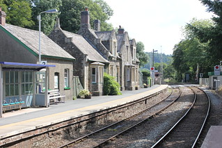
I shared a bench on the platform of Eggesford railway station with the train conductor. It was interesting to hear from him an explanation of the origins of the railway and the railway station that we were at. Apparently, the line runs through land belonging to the Eggesford estate. The permission of the lord of the manor, the Earl of Portsmouth, had to be sought to run the railway through his land. This was granted on the proviso that a station was provided (opened 1854) and all trains would stop there, hence we have today, Eggesford station, in the middle of nowhere.
An author of some notoriety, one Thomas Hardy, arrived at Eggesford Station in 1885, with the purpose of visiting Lord Portsmouth. A description of his experience he pens in a letter to his wife, ‘Dearest Em’, 13 March 1885. But, perhaps ironically, Eggesford station still serves a useful purpose to this day, long after the demise of the estate manor (abandoned in 1911) if not what was originally intended by his lordship.

I crossed a bridge spanning the River Taw and looking over a field gate I could immediately see my first objective, The Church of All Saints (Graded II* Listed). The last time I came by this way I was thwarted in my attempt to gain access to this church, but today I faired better. My guide book mentions this church, saying that it was an ‘estate church’, much the same as the nearby station. Now, with no estate, just like the station, it seems a little stranded in the countryside. But in a way, this adds to its charm.

On entering Eggesford Church, the first thing that struck me was the monument to Arthur Chichester, 1st Earl of Donegall on the north wall of the church. This is one of three quite imposing monuments to be found in this church, indicative of the power and wealth of the family on whose estate this church was erected.

The font in the church is said to be Norman but “much restored”. It’s a bit vague, the text of the church listing, as to what exactly that means. I, although no expert, can see elements of the font which suggest Norman construction, particularly in the column, but struggle to see Norman style in much of the ornamentation. A far more typical Norman font, for me at least, is the font to be found at Hemyock.
From the church I followed a track for a short stretch before entering a field and following the field boundary up a gentle slope. Glancing to my right I could make out a large house in the distance, which I presumed to be the ruin of Eggesford House (Grade II Listed). Conducting some map and satellite image checks subsequent to my walk confirmed my conjecture as having been correct. I was pleased to gain sight of the ruins of this once fine old house. I’ve long known of its existence, but this was my first sighting of it. At one time it was a substantial manor house. It was abandoned in 1911 and artefacts sold off at auction in 1913. The house was subsequently left to quietly decay. I understand that now there are just fragments of exterior walls left standing. Although not alone in suffering this dismal fate, it does seem rather a shame for a part of our country’s heritage to have evaporated in this fashion. I’ve included below an old photograph from the Historic England View Finder collection adjacent to my, heavily cropped (as I was some distance from the property) image captured today.
I dropped onto a lane not far from the Eggesford Fourways road junction. A war memorial stands in the centre of a small island in the middle of the road. From here I followed the opposite lane, past what looked to be a small terrace of old workers’ cottages. I then branched onto a track that took me through the farm buildings of Trenchard Farm onto a dirt track which hugged the side of a small strip of woodland, descending gradually as I went.
The track I followed led me into a lovely meadow on the valley floor. I didn’t need much persuading; this seemed the perfect place to break for lunch. Although I hadn’t clocked a great distance, this wasn’t to be a long walk, and so I had plenty of time in which to complete it. The day was warm, there was a delightfully summery vista, and I seemingly had the place to myself. That’s just how I like it.
After lunch my way took me into a field in which there was a herd of rather unusual looking cattle, not a breed I recognised. Undeterred by the length of their horns, and they seemingly only mildly distracted by my presence, I was soon on the banks of the River Taw, which I followed for some distance. I reached Chenson Bridge, a small hamlet, where I crossed over both the river and the railway via a level crossing. There appeared to be an old station building here.
Then, after crossing the main road, with considerable care, I began a gradual ascent of a hill along a lane, knowing all too well I’d reach the top of the hill only to start dropping off it. Such was the nature of this walk. On my way I passed a substantial free-range chicken farm. I crossed the main road again, this time in the opposite direction, crossed over the railway, yet again, this time over a bridge, and came upon a sign pointing the direction to Nymet Mill, my next objective.
I wasn’t sure quite what I’d find at Nymet Mill, a mill that dates back to the Domesday Book, as we’ve lost so many of our old mills as they fell into disuse at the beginning of the 20th century. The building today is merely a dwelling. It was nice to find the old waterwheel still in place, even if looking rather dilapidated. The mill owner came out and spoke with me. He said he hoped to one day restore the appearance of the old waterwheel. The only other semblance of the old mill I saw today was the old mill race leading from the mill back to the river valley, which could easily be traced on the boundary of the garden.
This next photo is a panoramic stitch which was about the only way in which I could capture an image of the mill building.

I encountered something of a potential hazard upon leaving Nymet Mill, in the form of a bull. The owner of the mill had warned me of this, and said I could cross his field if I preferred. I decided, on seeing the bull, and he seeing me, that discretion was the better part of valour. Back on my course, I then made a short detour to the church of Nymet Rowland, and was glad I did. This is a charming church containing much of interest. Perhaps one of the most striking things is the wooden arcade between the nave and the north aisle.
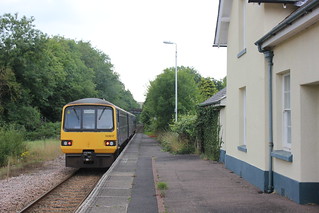
Leaving the village of Nymet Rowland I gradually came down off the hill towards the River Yeo and the Tarka Line. I headed for Lapford Station which I reached at 16:30, where I found a bench on which to eat a light snack and take a drink.
I suspected I would arrive in Lapford early for my train, and that was the case; I had just over an hour to spare, so I thought I’d walk into the village. On setting off, I passed by what was once the old Ambrosia factory, which today houses a removals company. At one time there was a railway siding into the factory, and although the rails no longer exist, the front of the building is easily recognisable as an old railway station. The factory was built in 1928. I believe the company, which remains in business, evacuated these premises in the early 1970s. At that time, the closure must have been a major blow to the work opportunities of those living nearby. However, as we know ambrosia is the food of the gods, we have to be grateful that it is still manufactured in Devon. I’ve included below an old photo showing the working factory, and adjacent to this I’ve included my image from today.

I wandered up the lane into Lapford, which is set on the hillside of the Yeo Valley. The village church, the Church of St Thomas of Canterbury, came into view, which I approached through the lych gate. Entering the porch I was immediately impressed by the old oak door that confronted me. Once in the church I came across the bench ends, many of which are medieval in origin. And things just kept getting better. I then came across the rood screen which is stupendous, which I subsequently discovered ‘is amongst the best in the country. I find that the church is Grade I Listed, and it’s easy to see why.
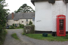
On leaving the church, I spent a little time exploring Lapford village. It’s a quiet and pretty village, benefitting from the fact that it is set high on the hillside, well away from the main road.
I then returned to Lapford railway station to catch my train back to Exeter. I always enjoy walking in Mid Devon as it is in many ways the traditional Devon that one sees. Few people seem to find their way to this countryside. It had been an enjoyable day’s walk.
Walk Statistics:
Total Distance: 11.7 km / 7.3 miles
Moving Time: 3hrs 05min
Stopped Time: 56min
Total Ascent: 289 metres
Maximum Elevation: 165 metres
Buses: (none)
Trains: Digby & Sowton to Eggesford – off-peak day return with Devon & Cornwall Railcard: £6:10
…… Normal ticket price, without railcard discount (33%) would have been: £9.20
Train out: 11:12 – 12:05 (0hrs 53mins) – no changes
Train return: 17:48 – 19:03 (1hrs 15mins) – no changes (from Lapford)


No comments:
Post a Comment