Synopsis: A hot day for walking, but glorious weather to be out in the country. Passed by the ponds of Cockington Court, a pleasant diversion. Berry Pomeroy Castle (EH) visible from the lake below.
The weather forecast for today indicated that this was a day not to be missed. With little time to prepare a walk, I decided upon this route, a walk I’d done before, at least twice. This is a walk I like very much, and it’s easy to do using buses for transport, which is ideal. A recent visit to Cockington Court suggested to me that it was possible to track a path through the grounds that would add a little variety, which is what I did.
I got off the bus at Abbey Gardens and walked through the park down to the coast. It was only a brief stretch of the coast I was due to walk before heading inland. The path follows the stream that flows past Cockington Court to the sea. A popular route, there were many walkers using this path.
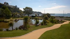
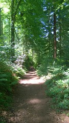
As mentioned above, I detoured from this path just before reaching the village, entering the grounds of Cockington Court through a gate by a lodge beyond which is the lowest of a series of 3 interconnected ponds. I traced my way around these, admiring, as always the gunnera that grow adjacent to the ponds. Then, near to the gamekeeper’s cottage, I picked up a path that took me into the woods.
At a point where my path crossed a lane, I could potentially have picked up a trail from a stile that would have taken me down to Cockington Court, but I decided against that today. Instead, I continued along a path that connected with the public footpath that runs out the back of Cockington Court.
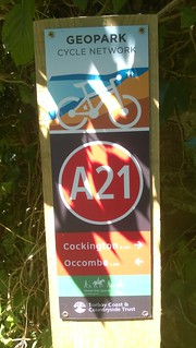
As I set off on this route, I came across this waymark that indicated the existence of a cycle trail [Cockington Valley Loop - Geopark Cycle Network]. I subsequently contacted Torbay Tourist Information about this, but it was not known to them. After hunting around on the web for a while I did find some marketing information (www.behance.net & www.fruition-design.co.uk), but no official publication. The web site that is referred to on some of these posts does not exist (www.geoparkcyclenetwork.org.uk). All rather odd. I did map what I think is the route based on this marketing information, a map which can be viewed on Bing Maps, but this is completely unverified and unofficial, so I can’t vouch for its accuracy (see addendum below).

The nastiest part of this walk is having to cross a very busy road which is a dual-carriageway. I took an awful lot of care in crossing this road. But once across this road, I was once again in a very quiet lane, and that was going to be the last I’d see of traffic till the end of this walk. I was soon entering the pretty village of Marldon. Pretty it may be, but it’s a very steep climb out of this village to gain the public footpath I was intent on following.
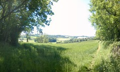
The walking was easy from Marldon to Berry Pomeroy Castle (English Heritage), following a path that traced field boundaries, gradually losing height along the way. This is part of the John Musgrave Heritage Trail, to which my post heading alludes, and this I will follow into Totnes. Be warned! the entire route of this trail is 56 km / 35 miles in length, and thereby, not for the faint hearted (like me).
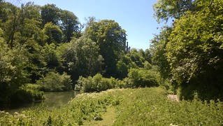
I had planned to have a picnic on the grass by the lake just below the towering Berry Pomeroy Castle, as a more atmospheric spot is hard to imagine. But, on reaching this place, I realised there would be no shade, and on a day like this, the noonday sun was simply to much to be sitting in. So, reluctantly, I decided to walk on, eventually entering the shade of some trees, where I perched to eat my lunch.
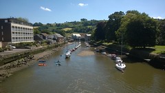
After lunch, my walk continued through woods for quite a while before finally connecting with lanes. My walking was straightforward from this point, following lanes and tracks into Totnes, with only one final hill to climb just before Totnes. The lanes, though I must confess, on this day, were really hot. Although not really a long distance walk, I was pleased to reach Totnes, and find a place to sit in the shade of the bus shelter.
I only had a 40 minute wait in Totnes for a bus that would take me back to Exeter. It had been a lovely walk on a fabulous day. What more could a person wish for?
Addendum: Since first writing this post, I have now (on 9th August 2015) walked what I believe to be the route of this ‘intended cycle trail’. I have improved the accuracy of the cycle trail as plotted on Bing maps (link above) based upon my findings on having walked the route. If you are considering cycling this trail, it would be advisable to read my later blog post, as this contains supplementary information.
Walk Statistics:
Total Distance: 15.4 km / 9.0 miles
Moving Time: 3hrs 38min
Stopped Time: 31min
Total Ascent: 353 metres
Maximum Elevation: 155 metres
Buses: X46 & X64




No comments:
Post a Comment