Synopsis: A walk around the Heavitree Parish Boundary seeking marker stones as we went. Five go on a beating the bounds walk. Great views from Stoke Woods. Excellent company. A superb day. Very hot!


(selection of photos from Flickr photo album – use link above to view album)
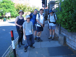
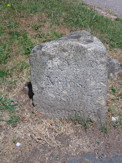
Five plus one actually. This organised walk by the Heavitree Local History Society came as rather a surprise to me, as my understanding was it is normally undertaken on a 3-year cycle, and I was aware it had been walked last year. I spotted it on the group’s web site, and thought I’d like to tag along, if they’d have me. The society members participating in the walk welcomed me to their party at the Livery Dole start point, adjacent to the first boundary marker - marker stone No. 1 of 10
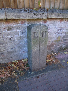
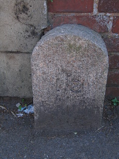
The idea of the walk is to follow the Heavitree Parish boundary reasonably closely, and visit each of the 10 remaining boundary markers still in place. A number of the markers have an interesting reclamation story behind them, such as this one in Polsloe Road. Terry saw it discarded on a pile of rubble beside the road and organised it’s replacement here by a road crossing.
Heavitree is a large parish, and correspondingly, the boundary is lengthy. Today’s walk, for those doing the complete circuit, would be over 14 miles. Some in the party would be opting to do half today, and complete the other half next week. We passed the old Female Reformatory [Old-Maps - 1891 1:500 scale] in Polsloe Road, crossed at the busy Mount Pleasant junction, and followed the Mount Pleasant Road to the junction with Old Tiverton Road. Here the next boundary stone was found smack bang in the middle of the road.
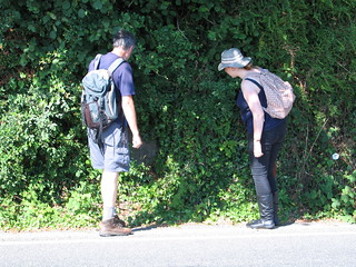
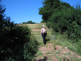
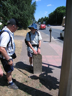
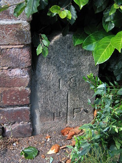
We then headed up Rosebarn Lane to the very top of the hill, where the next boundary marker stone was to be found, after a little ferreting in the hedge. Mike came prepared, and with secateurs to hand, cleared some of the vegetation so that we could see the marker stone.
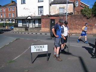
We followed Pennsylvania Road for a short distance before detouring right on to a dirt track with a tunnel hedge providing some welcome shade from the relentless sun. We were soon at Stoke Hill Camp [Historic England List], and old Roman signal station. Nothing significant remains on the surface today, but it was pleasing to reflect on the camp’s past.
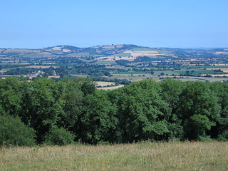
It wasn’t long before we reached a farm where we connected with a footpath. From here we headed right. This next stretch offered some of the finest views of the walk. It was possible to see for miles. In the landscape it was easy to identify Brampford Speke and Stoke Canon. And in the further distance the mound known as the Killerton Clump [National Trust] was very recognisable. This, perhaps rather surprisingly, is an extinct volcano.
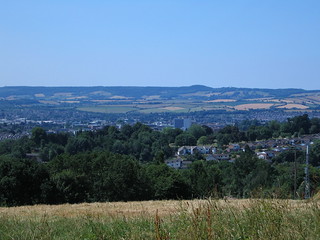
We continued on in this general direction until we connected with Stoke Hill Lane, where we branched right. We eventually connected with Mile Lane, a dirt track running off to the left. From the intersection there was a terrific view out over the city, one of the best I’ve ever come across. Exeter Cathedral could just be made out behind the John Lewis building.
For a while we detoured into the Mincinglake Valley Park [ECC], simply because the walking was more pleasant than that of Mile Lane. We stopped briefly for refreshment. Continuing on, we connected with Beacon Heath Road, turned left, and walked as far as a park, Exhibition Fields, on the right. We walked through this park and then on to Pinhoe Road.
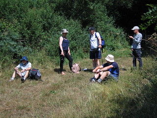
This is where we came upon the next parish boundary marker, beside this busy road. I lived in Pinhoe once, and must have cycled past this marker stone hundreds of times without realising it was there. Crossing the road we found ourselves in yet another park in which we found some shade under trees to sit and eat our picnic lunches.
We noticed a new pub established nearby, The Pinhoe Hoard [Marston’s], and wondered at the naming. Apparently it honours the discovery of Bronze Age artefacts discovered in 1999 by Jim Cobley [Historic Environment – DCC] (how Devonshire is that?).
After lunch we walked on until we picked up Pinn Lane. This is much changed from when I lived in Pinhoe, with business offices and residential developments now all around in what was once just a country lane. The next boundary marker was found where this lane connected with the extremely busy Honiton Road. Once again, this was a marker stone on the verge of oblivion when reclaimed by Terry.
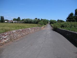
The group split at this point, with those doing half the walk today leaving us foolhardy few doing the full distance, Sally, Jonathan and myself. A little bit of busy street walking was now required to get us to the next marker stone, perhaps the one most unusually sited. It stands against the parapet of Clyst St Mary Bridge and Causeway [Historic England List], a listed monument. Despite the hurly burly all around, this is a great survivor, and I always like to see it. The route is originally Roman, the bridge medieval.
Sally was running short on drink, so we walked into Clyst St Mary to find the convenience store at which to top up our supplies. A chilled drink was most welcome.
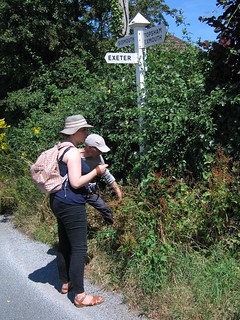
It wasn’t a great distance from here to our next marker stone, once again almost hidden in the vegetation of the hedge. The fact that the marker stone’s position is next to a modern road sign increased our chances of finding it.
We had quite a walk ahead of us to reach our next marker stone, a good deal of which was road walking. We crossed the busy Bridge Road using the pedestrian bridge, and then walked through the King George V Playing Fields. We were headed for the mill race known as St Jame’s Leat that once fed the old paper mill at Countess Wear. We cut in at Matford Lane, eventually reaching Magdalene Road, where our next marker stone was found. Sunk deep in the ground, only the top part of the stone is now visible.
We cut through the grounds of St Luke’s College making our way to Heavitree Road where we found the last of the set of boundary maker stones, sited against the wall of a staff building attached to the St Luke’s complex. The marker stone did look a little forlorn, but at least it was there making a stance after all this time.
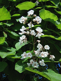
A short stroll to the top of the hill took us back to our start point of Livery Dole. It had been an extremely interesting day, and I felt walking the boundary was a great thing to have done. The day had been made all the more enjoyable by the delightful company of those on the walk party today. As we merry three wended our way homewards, I happened to notice the Styrax Obassia tree was in bloom, and how pretty it looked too.
P.S. The ‘Tracklog and Photos - Google My Map’ link at the top of this blog post presents outlines drawn on this map of both the Heavitree Parish Boundary and the Heavitree and Whipton Barton Ward. The Heavitree Parish Boundary is based upon information obtained from the Heavitree Local History Society web site. The outline of the Heavitree and Whipton Barton Ward is based upon information obtained from the Devon County Council web site. The map I have supplied contains web links to the source information that I used when compiling my map.
An impression of the weather today, and this summer, from news articles:
• Heatwave unveils ancient settlements – BBC News 07/07/2018
• UK heatwave: Hidden landscapes the heatwave is revealing – BBC News 17/07/2018
• Lake District village ruins revealed by water shortage – BBC News 18/07/2018
• The dramatic effect of the UK heatwave – BBC News 19/07/2018
• UK weather: Driest start to summer on modern record – BBC News 20/07/2018
• UK Heatwave 2018: The winners and losers – BBC News 21/07/2018
• UK heatwave: Met Office says 'stay out of the sun' – BBC News 23/07/2018
• The dried parks and parched lawns of Britain [In Pictures] – BBC News 23/07/2018
• UK heatwave: Temperatures set to rise as alert continues – BBC News 24/07/2018
• Hot Dry Summer Reveals Hidden Archaeological Sites in England – Historic England 15/08/2018
Walk Statistics:
Total Distance: 23.28 km / 14.3 miles
Moving Time: 5hrs 39min
Stopped Time: 1hr 50min
Total Ascent: 438 metres
Maximum Elevation: 165 metres
Buses: (none)
Hi Robert, very pleased to have located your blog. I'd written your name down wrongly, and was searching for Robert Slade! Great post about the boundary walk. I'm glad you enjoyed it - I did too, although I injured my foot and couldn't walk for about a week after. Time to invest in some walking shoes perhaps. I'll look forward to reading some of your other blog posts once I get this latest wretched HLHS newsletter written! Hope you are well, Sally
ReplyDeleteOh, also, would it be ok to link to your blog post in the HLHS newsletter? Not all members have internet access, but I reckon a few (certainly those who walked with us) would be interested...
ReplyDelete