Saturday, 30 January 2010

30 January 2010 – Walk: Ottery St Mary (10.7 Miles)

Synopsis: Ottery St Mary and East Hill Strips. Icy start with a dusting of snow on the ground. Views from Beacon Hill looking out to Sidmouth quite spectacular. A superb walk!

GPS Tracklog Download (.gpx) Microsoft OneDrive -:- Google Drive
 
 
Ottery St Mary 003Ottery St Mary 009Ottery St Mary 019Ottery St Mary 025Ottery St Mary 026 
(selection of photos from Flickr photo set – use link above to view album)

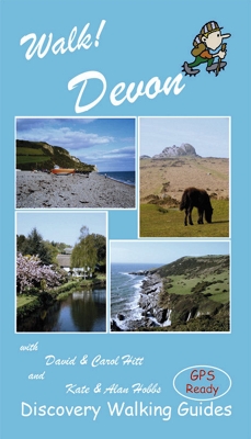
This walk is route 14 from the book Walk! Devon. The day was cold and there’d been a dusting of snow overnight. I was up early as I wanted to get a meal in my slow cooker for later and I was keen to catch the 8:30 bus. Things became dicey even before I got to the bus as the steep path to the bus stop was very icy and watching cars slithering about the road was sufficient warning to take extreme care. Safely ensconced on my bus I was at the walk start in Ottery and on my way by 9:10.

Ottery St Mary 002Starting out from Ottery St Mary

The sky was clear, the air fresh and the snow-dusted fields gleaming in the early morning sun. With just the odd dog walker and jogger for company, I left the outskirts of Ottery following a path from the bridge along the River Otter, warding off an attack from a Jack Russell.


Ottery St Mary 010Landscaped wooded garden


Not far out from Ottery I came across what my guide book describes as a ‘landscaped wooded garden’. It does rather look as if someone’s garden has spilled over a little valley, with the path taking me past some non-native plants such as tree ferns. One of the nice things about snow is that every animal that walks over it leaves its mark. It’s evident that deer were out earlier than me this morning.

Ottery St Mary 021Trig point with view down to Sidmouth

It wasn’t long before I start my ascent up an ice covered lane to East Hill Strips. At the car park at the top my track took me into the woods. All along this section of the walk there are tremendous views out across the valley of the River Otter. Then, finally, out near a trig point I was afforded with the best view of all, out to Sidmouth and the coast. This is a truly stunning view, one that my photograph fails to do justice.


From here the path zigzags down the hills side through heather and gorse then picks up a lane which took me down off Beacon Hill to pick up the course of a dismantled railway through Harpford Wood. This was the route of the old Sidmouth Railway Company line between aforesaid place and Ottery St Mary. At its peak in the 1930s as many as 24 trains ran on this line daily. Sadly it went the way of so many lines during the Beeching cuts of 1966.

Ottery St Mary 027Old mill on River Otter

Just past the village of Tipton St John the path regains the River Otter near an old disused mill. I find a sheltered spot nearby to break for lunch and brew up a nice cup of tea. There’s an impressive weir just up from the mill which is the draw-off point for the water that once drove the mill. I see quite a few egrets out fishing this stretch of the river.


Ottery St Mary 036Approaching Ottery St Mary


The walk from here is level and easy. It makes for a casual and easy two mile stroll back to Ottery St Mary. I see some baguettes in a bakery window and think to myself they would would make a nice accompaniment to my supper, only to find out on asking they’re purely decoration and there are none to be had. I guess a wax baguette would lack flavour.


It’s the same friendly bus driver who picks me up as took me out in the morning. He asked me how my walk had been and I was able to report it had been a splendid day full of glorious views. By now I was looking forward to my Devon Turkey, turkey and bacon cooked in celery, mushrooms, apple and cider, washed down with a glass of scrumpy. Now that’s what I call a little of the good life.

Walk Statistics:

Total Distance: 10.7 miles
Moving Time: 4hrs 11min
Stopped Time: 50min
Total Ascent: 371 metres
Maximum Elevation: 239 metres

Buses: 380 & 60A

Saturday, 23 January 2010

23 January 2010 – Walk: Woodbury Common (9.9 Miles)

Synopsis: A 2.500 year old hill fort, home of Sir Walter Raleigh, and a pebble heath land. The latter being how Woodbury Common is described on the various information boards I passed today.

GPS Tracklog Download (.gpx) Microsoft OneDrive -:- Google Drive
 
 
Woodbury Common 001Woodbury Common 005Woodbury Common 008Woodbury Common 016Woodbury Common 034 
(selection of photos from Flickr photo set – use link above to view album)

Walk! Devon
Walk! Devon

This walk is route 16 from the book Walk! Devon. This is a favourite book of mine, as the walks are very well written up, easy to follow, and each is provided with Ordnance Survey 1/25,000 maps. All the walks are ‘GPS Enabled’, by which is meant that each has a table of waypoint grid references that can be loaded to a GPS unit to facilitate easy navigation. To see other walks from this book that I have completed, use the link under Tags to the right.

It was a bit of a challenge making it by car to the start point, although it is less than 10 miles from home. My old banger was overheating and I felt I was lucky to make it to the start. More trouble ahead for next week, but that could wait for now.

There was quite a lot of early morning mist about, as forecast, but this was already starting to burn off as I set out on my walk a little after 10am. Soon into the walk I was afforded excellent views out over the Exe Estuary.

Woodbury Common 007Seagull heaven!

I think the quarrying must have been extended since the book was compiled as I couldn’t follow exactly the route in the book. There were large lakes to be seen as I crossed through the strange landscape of the quarry workings. Seagulls seemed unperturbed by their strange surrounding and even found the lakes rather accommodating, judging by the numbers of them.

There were several fishermen out with their tackle on Squabmoor Reservoir. It never ceases me how much equipment it takes to catch a few minnows. They’re obviously very crafty little buggers; the minnows that is!

Woodbury Common 018Babes!


Pigs as far as the eye could see, is what one section of the walk felt like. Certainly some intensive pig farming going on. The little ‘babes’ weren’t as hemmed in as their mothers, as they were able to duck under the electrified wires. The were dashing out onto the track in front of me and then looking a little unnerved as I approached and dashing back to the safety of mum. They would then come back for another look, their curiosity once again getting the better of them.


The walk took me by Hayes Barton, the birthplace and home of Sir Walter Raleigh, favourite of Queen Elizabeth I, beheaded by James I. Well, I suppose you can’t win them all! I guess the old cloak and the rain puddle trick didn’t go down so well with James. Stupidly, despite walking right past Hayes Barton, I failed to get a good shot of it, so you'll have to make do with this linked page.

I must be getting walk fit again, as I didn’t feel so exhausted by this walk as others I’ve done this year. I did take note that there were a lot of mountain bikers about, and I could see the attraction. I really must compile a little circuit of my own some time.

P.S. And yes, this was to prove to be the final outing of my Renault 19 Biarritz. I suppose the smoke pouring from the exhaust was a telltale sign that things were not all correct. Still, the car was 16 years old, 13 years of which I had owned it, so I can hardly complain. A couple of weeks after this walk I did receive a cheque for £40 in the post form my garage, the princely sum that my car was worth. I guess Stage Coach will be seeing more of me in the months ahead.

Walk Statistics:

Total Distance: 9.9 miles
Moving Time: 3hrs 46min
Stopped Time: 27min
Total Ascent: 338 metres
Maximum Elevation: 181 metres

Buses: None – just a beat up old car!

Sunday, 17 January 2010

17 January 2010 – Walk: North Bovey (10.0 Miles)

Synopsis: The River Bovey was in full torrent on this day. Walk started from the pretty little village of North Bovey. Lovely views to be had from Easdon Tor of Hound Tor with Haytor in the background.

GPS Tracklog Download (.gpx) Microsoft OneDrive -:- Google Drive
 
 
North Bovey 002North Bovey 006North Bovey 020North Bovey 032North Bovey 055North Bovey 066
(selection of photos from Flickr photo set – use link above to view album)

I thought it would be interesting to try and get some photos of a water fall as rivers were likely to be in full torrent as the recent snows and ice melt. This was the main motivation for this walk. I also stumbled upon some views from Easdon Tor that were new to me; it was nice to find after all these years walking on Dartmoor there are still places for me to discover.

North Bovey 003North Bovey

The walk started from from the pretty little village of North Bovey. I sat on a bench in the square to put my boots on, looking over thatched cottages to the church.

It was my objective to cross the River Bovey near Horsham Cleave as I know the waterfalls here are quite spectacular. As I approached this point I could see the river was extremely fast flowing from all the water now draining off the moor. This was a little daunting, as I knew that I’d have to go out on rocks in the river to both take photographs and to proceed on my way. This looked like it could be something of a challenge.

North Bovey 047River Bovey


When I got to the waterfalls I’m reminded it’s not so bad as it might seem. Somehow this mass of flowing water is directed under a range of massive boulders and crossing is almost as easy as if there were a bridge there.

The water is whipped up by the drop and splashes of foam were darting into the air. The sun was shining through the trees highlighting the waterfalls beautifully. I installed my camera on my tripod and precariously perched it on various boulders out in the river.

North Bovey 057Hound Tor

From the waterfalls my path on the other side of the river wound up amongst trees in the direction of Water, most appropriately named village that this is. After Water it’s not long before I pick up a track ascending gently towards open moorland. I climb a tor just a little aside from Hound Tor and here I stopped, perched on a ledge sheltering from the wind, to eat my lunch and brew up. As I gaze out on Hound Tor I recall fun times of when I would bring Helen and Laura here when they were younger as they loved to scramble over the rocks of this tor.


North Bovey 068Jay's grave


After lunch I set off in the direction of Jay’s grave. There’s a mysterious story of a young woman, Kitty Jay, becoming pregnant by a local farmer’s son and then taking her own life by hanging herself in a barn. The grave is clearly visible at an intersection between road and track. It’s almost as if this is meant to serve as a warning to passers by. Apparently ‘crossroads burials’ for criminals and suicides are documented as early as 1510. The gravestone always has fresh flowers and other offerings on it. On this day I discovered a necklace entwined around the cross, some coins and a bottle stopper, along with the usual flowers.


I followed the road from Jay’s grave until picking up a track that took me up towards Easdon Tor. I’d not previously been up this way and found that it offered a splendid view out towards Hound Tor and Haytor beyond. From here the path descends down through a small copse to the road which leads back into North Bovey.

I must have been a little unfit from lack of exercise over the Christmas holidays, as I was really quite tired on arriving back at my car. The nice thing about tiredness from walking is that it is such a satisfying form of tiredness. I always look forward to relaxing in my armchair after such a day as this.

Walk Statistics:

Total Distance: 10.0 miles
Moving Time: 3hrs 59min
Stopped Time: 51min
Total Ascent: 490 metres
Maximum Elevation: 392 metres

Buses: None; parked in the square, North Bovey.

Saturday, 9 January 2010

09 January 2010 - Walk: Topsham to Exeter (15.7 Miles)

Synopsis: An icy walk to Topsham and then along the canal back to Exeter.

GPS Tracklog Download (.gpx) Microsoft OneDrive -:- Google Drive


Topsham to Exeter 005Boats at Topsham

I didn’t fancy taking my car out today as there was still a lot of ice about on the roads. For that reason I settle on a walk to Topsham. Even the walking was treacherous and several times on my route to Topsham I nearly lost my footing. Later in the afternoon I attempted a steep slope and lost my grip and wound up sitting on ice.

Small rafts of ice could be seen floating down the river and boats on the water were making crunching sounds as they carved their way through these sheets of ice.


Topsham to Exeter 035Ice and snow covered Exeter Ship Canal

I had a picnic lunch at Topsham, which wasn’t as cold as it might sound. Finding a boat mooring to sit on out of the wind it was quite pleasant sitting in the sun watching the flocks of geese swooping in masses and making a considerable noise.

After lunch I walked along the banks of the River Exe before joining the tow path along the Exeter Ship Canal. As can be seen in the photograph left, the canal had frozen over and snow had accumulated on the ice. It made for a very nice picture as I strolled in the direction of the city centre. There were hordes of people feeding the swans, ducks and seagulls down on the quay.

I did a little Christmas shopping in town (yes! no kidding; actually have some presents for next Christmas). I then walked to the hospital to visit Mum. Later in the evening I dropped in on Wendy, Colin and Kate and we had supper together.

Walk Statistics:

Total Distance: 15.7 miles
Moving Time: 8hrs 31min
Total Ascent: 296 metres
Maximum Elevation: 69 metres

Buses: None

Friday, 1 January 2010

01 January 2010 – Walk: Lustleigh (3.7 Miles)

Synopsis: A quick dash along a frosty Lustleigh Cleave.

GPS Tracklog Download (.gpx) Microsoft OneDrive -:- Google Drive


This was a relatively short walk, but just long enough to give me some fresh air, and demanding enough for me to feel exercised afterwards. It’s a familiar walk along Lustleigh Cleave and the banks of the River Bovey. The weather was cold and crisp but the sun shone which made this, my first walk of the new year, very pleasant.

Lustleigh 003Hunters Tor

There are splendid views from Hunter’s Tor out towards Haytor on Dartmoor. I hadn’t realised at the time but Helen and Laura were probably on Haytor as I looked out upon it, as their cousin Christopher had taken them out for the day in his ‘flash sports car’. These were Laura’s words. Ok, it does look a little more flash than mine, but then, most cars do.


Lustleigh 023Brightly coloured fungus


This brightly coloured fungus was growing on the side of a tree. At least, that’s what I presume this is. I’ve not seen anything quite like it before.


Walk Statistics:

Total Distance: 3.7 miles
Moving Time: 1hrs 46min
Stopped Time: 26 min
Total Ascent: 206 metres
Maximum Elevation: 332 metres

Buses: (none)